Subject: Los Angeles, California
Period: 1888 (circa)
Publication:
Color: Black & White
Size:
7.8 x 7.7 inches
19.8 x 19.6 cm
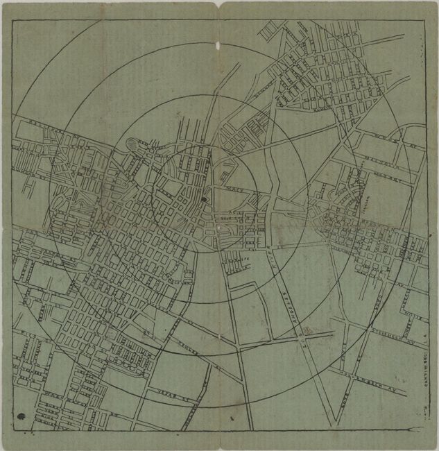
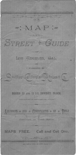
This rare, untitled bi-fold map of downtown was drawn by Cantin Engineering, printed by George Bentley, and presented by the Southern California Abstract Co. It shows concentric circles from a center point where Los Angeles and Macy Streets converge with most of the city's development to the west. The rear wrapper features a “Directory of Principal Streets.” Los Angeles experienced rapid growth through subdivisions in the 1880s and by 1888 had a population of about 50,000. The circa date is based on a newspaper account of the company’s incorporation on August 9, 1888, and the presence on the map of Charity Street, whose name was changed in 1887 to Grand Avenue, which is listed on the rear wrapper as “Grand Av, formerly Charity." This is the only known example of this map.
References:
Condition: B
There is some light soiling and 2.5" and 1.25" fold separations at top and bottom that have been closed on verso with archival tape. Folded into quarters by a previous owner with some tiny loss along the fold lines and a small tear.