Subject: Arkansas
Period: 1850-97 (circa)
Publication:
Color:
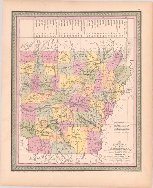
A. A New Map of Arkansas with Its Canals Roads & Distances, by Thomas, Cowperthwait & Co., from Mitchell's A New Universal Atlas, dated 1850, hand color (11.8 x 14.5"). This attractive and early map of Arkansas shows county configurations for 1845, with the newly organized Dallas County included. The map has many towns named, and a number of roads criss-cross the map. The number of miles between towns is helpfully noted, and at the top of the map the steam-boat routes are noted from Little Rock to New Orleans, Pittsburgh, and Fort Gibson. Thomas, Cowperthwait & Co. acquired the plates and rights to Mitchell's important atlas in 1850. Its edition of the map has been updated to show the new proposed railroads but is otherwise unchanged. Condition: Near fine with contemporary color and minor spots mostly confined to the blank margins. (A)
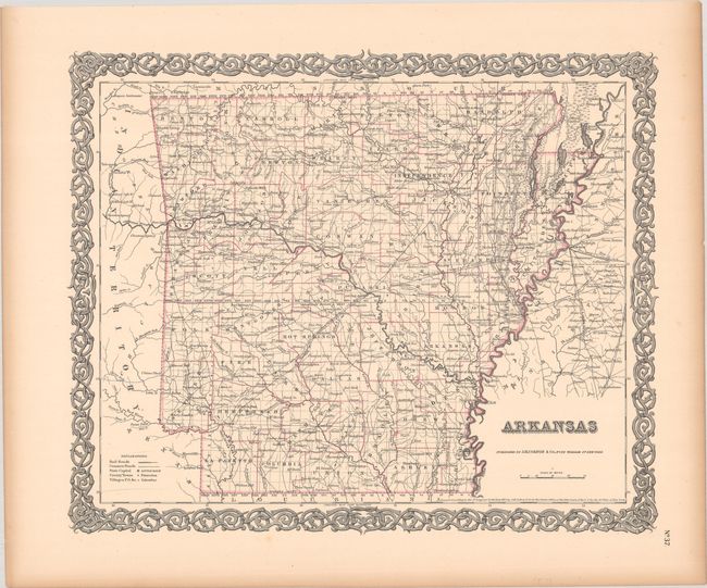
B. Arkansas, by Joseph Hutchins Colton, dated 1855, hand color (15.6 x 12.8"). This steel-engraved map depicts Arkansas and its counties. Towns and cities, post offices, and roads, are located. The proposed Cairo & Fulton, Ft. Smith, and Memphis & Little Rock railroads are noted, but no completed railways are shown. In addition to county divisions townships are delineated along with the principal meridian and baseline. The map is surrounded by Colton's typical strapwork border with unusual single color in outline. Condition: Contemporary outline color with marginal toning.
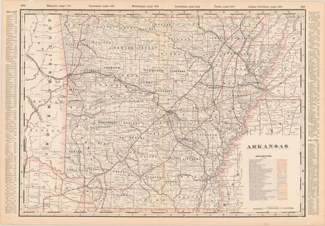
C. Arkansas, by George F. Cram & Co., from Cram’s Standard American Railway System Atlas of the World…, published 1897. printed color (22.3 x 16.3"). This impressive map emphasizes the railroad network with a color-coded key identifying the various railways. It is accompanied by the corresponding index sheet describing the railroads, counties, and towns. Condition: There is a small chip in the upper blank margin and a short centerfold separation in the bottom blank margin, both well away from map image, else fine.
References:
Condition: A
See description above.