Subject: Arizona
Period: 1865-1920 (circa)
Publication:
Color:
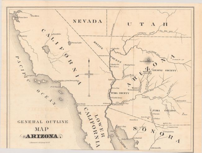
A. [Map with Booklet] General Outline Map of Arizona [with] Arizona: Its Resources and Prospects..., by A. Brown & Co., published 1865, black & white (11.7 x 9.1"). A basic map covering Arizona and portions of California, Nevada, and Utah. There are 4 counties in Arizona and Mojave County takes in the southern tip of present-day Nevada. Locates the Mowry and Heintzelman mines along the border with Mexico. Laid into the 22-page report. Condition: Issued folding with faint foxing and the bottom border has been trimmed at left by the binder. Text is lightly toned. Wrappers have minor wear. (B+)
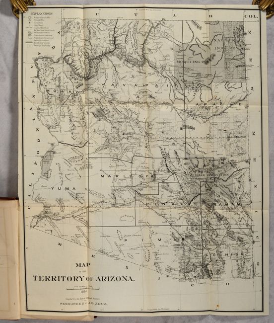
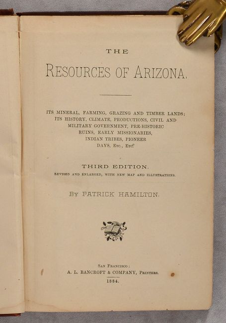
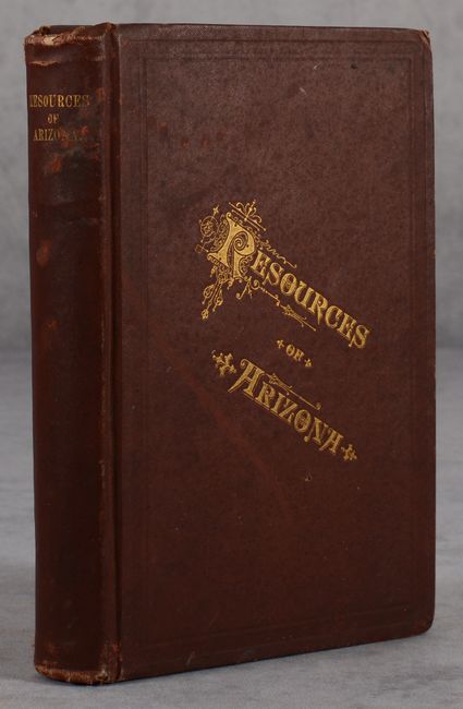
B. [Map in Book] Map of the Territory of Arizona [in] The Resources of Arizona..., by Patrick Hamilton, published 1884, black & white (16.0 x 19.5"). A highly detailed map of the territory showing 9 counties and several large Indian Reservations. A legend at top left identifies U.S. land offices, railroads, railroad grant limits, private grants, military reservations, Indian reservations, and more. Still bound into the 414-page volume with 19 illustrations and 14 pages of advertisements. Hardbound in maroon cloth with gilt tile on the front cover and spine. Condition: The folding map is fine. Text is lightly toned. Covers are soiled and worn. (Map: A+, Binding: B)
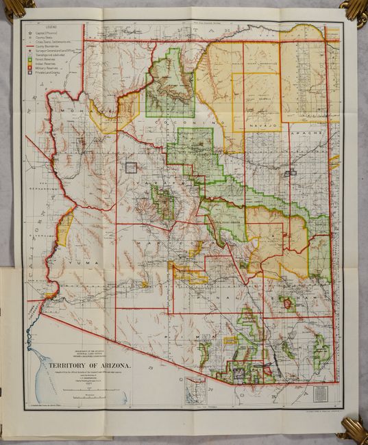
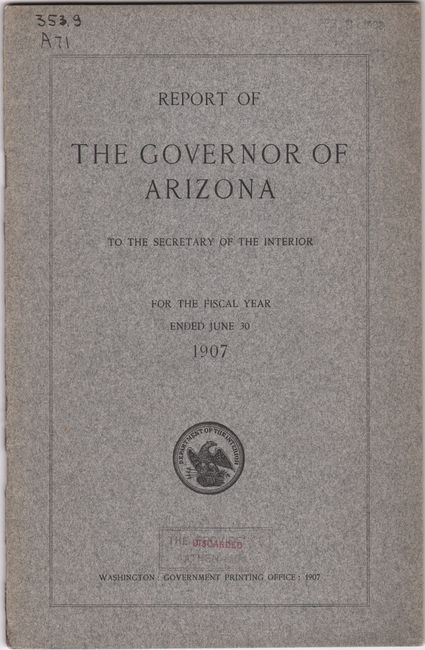
C. Territory of Arizona, by General Land Office, dated 1907, printed color (16.8 x 20.3"). A colorful map with great detail issued just five years before Arizona attained statehood. The map clearly shows Indian Reservations, Military Reservations (Fort Apache, Fort Grant, Fort Huachuca and Fort Whipple) and Forest Reserves via different colors. A huge Grand Canyon Forest Reserve is shown and the new Petrified Forest National Monument (established in 1906) is located east of Holbrook. Details include watershed, mountains, railroads, wagon roads, private claims, unsurveyed townships, etc. The map is still bound into the 38-page "Report of the Governor of Arizona" with gray paper wrappers (5.8 x 9.0"). Condition: A clean and colorful example with a short binding tear at left that has been closed on verso with archival material. Report is very good with a "discarded" stamp on front cover. (A)
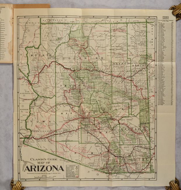
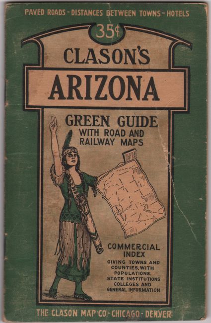
D. Clason's Guide Map of Arizona, by the Clason Map Co., circa 1920, printed color (15.0 x 17.6"). This folding pocket map is complete with descriptive booklet, "Clason's Arizona Green Guide" (4 x 6.3"). The map delineates early Automobile Roads and Main Automobile Roads via red overprinted lines of different sizes. The transportation network contains a remarkable number of roads and highways. The legend also locates the state capital (Phoenix), county lines, county seats, railroads, rail trunk lines, Indian reservations, and National Forests. The map shows Greenlee County, created from part of Graham County in 1909. The booklet also contains a Mileage Map of the Best Roads of Arizona (12.1 x 15.6"). Folds into paper covers with 32-page booklet "Showing all the Best Roads Clason's Arizona Green Guide…" which includes full-page city plans of Tucson and Phoenix. Condition: The folding maps are clean, bright, and near fine. Covers are worn. (A)
References:
Condition:
See description above.