Subject: New England, New York & Pennsylvania
Period: 1875 (circa)
Publication:
Color: Hand Color
Size:
26.4 x 16.3 inches
67.1 x 41.4 cm
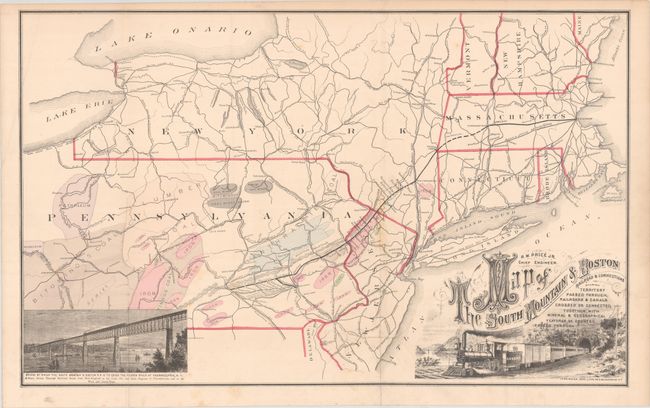
This uncommon map by R.M. Price shows the route of the short-lived South Mountain & Boston Railroad, which had grand plans of connecting Boston, MA with Harrisburg, PA via a connection with the Massachusetts Central Railroad at the state line. This plan would have provided a direct rail connection from New England to the coal, oil and slate region of Pennsylvania. The company was unable to realize its plans and the history of the route is filled with numerous bankruptcies, foreclosures, and name changes. The map is colored to show the rich mineral deposits throughout the region. It is decorated with a fine title cartouche featuring a train that was drawn by W.W. Denslow. In the opposite corner is a vignette of the bridge where the railroad was to cross the Hudson River. Lithographed by Ferd. Mayer in New York. According to Modelski, this map appeared in Beers' County Atlas of Lebanon Pennsylvania and the New Illustrated Atlas of Westmoreland Co., Pennsylvania.
References: Modelski (North America) #61.
Condition: B+
Issued folding with light scattered foxing and a 2.5" tear at lower center that has been closed on verso with archival tape.