Subject: United States
Period: 1844-53 (dated)
Publication:
Color: Hand Color
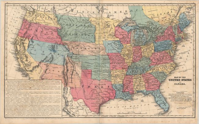
A. Map of the United States Canada and a Part of Mexico. To Illustrate Olney’s School Geography, by D.F. Robinson, from Olney's School Geography, dated 1844 (17.6 x 10.6"). This map shows Texas in its largest configuration with its panhandle extending well to the north into present-day Colorado. The map is dated 1844 but circa 1848 with a large Upper California separated from Mexico by an engraved border. Along the western border of Texas is a small region named Santa Fe or New Mexico. A huge Nebraska Territory occupies the northern plains with Indian Territory to its south. Oregon Territory reaches to the Continental Divide. The map has terrific territorial configurations and is filled with information on forts, Indian tribes, waterways and more. Copyright below neatline by D.F. Robinson. Drawn and engraved by Sherman & Smith, N.Y. Condition: There is light soiling, a bit of offsetting, and a 5" centerfold separation at bottom that has been closed on verso with archival materials. (B)
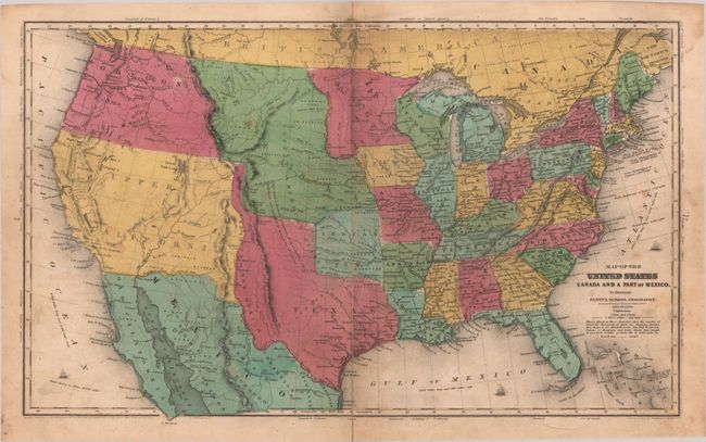
B. Map of the United States and Canada, by Daniel Burgess, dated 1853 (17.8 x 10.7"). A great school atlas map with full contemporary hand coloring to delineate the early territorial borders in the west. The territories of Washington and Oregon extend to the Continental Divide, while Utah is a huge area that extends from California to the Continental Divide. New Mexico Territory occupies all of today's Arizona and part of Colorado and the border with Mexico is along the Gila River. A huge North West Territory extends between the Continental Divide and Minnesota and is bounded by Canada and Nebraska. A large Gold Region is shown in north central California. Most states and territories are labeled with their population. Large panel at lower left is a teacher's aid with questions. The verso contains a small map of eastern Canada. Condition: On a bright sheet with some light staining. (B+)
References:
Condition:
See description above.