Subject: Atlases
Period: 1783 (circa)
Publication:
Color: Hand Color
Size:
10.8 x 15.5 inches
27.4 x 39.4 cm
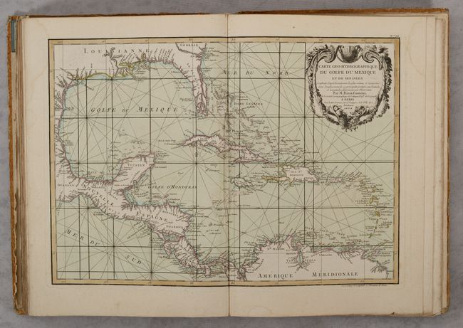
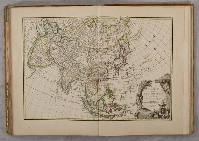
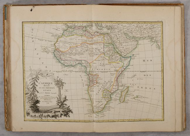
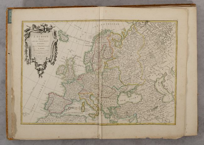
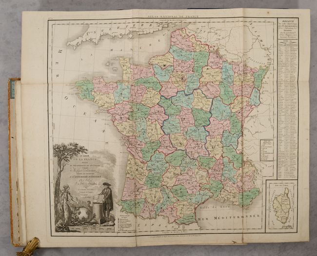
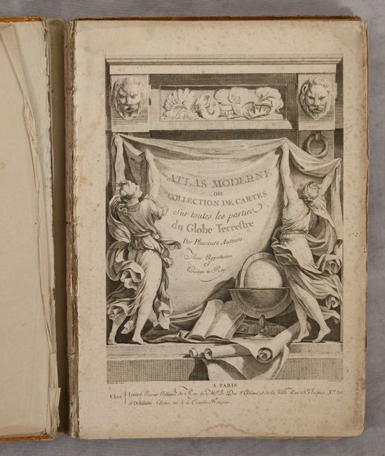
This complete atlas contains 37 double-page maps of all regions around the world, an engraving of an armillary sphere, and a lovely title page featuring a globe, atlases, maps, and symbols of the four continents. The list of maps calls for 35 maps, however this example includes an additional large folding map of France (19.7 x 22.9") and map of French departments. The contents consists of a world map, 24 maps related to Europe (with a four-sheet map of Germany and two-sheet maps of France and Italy), 4 maps related to Asia, 3 maps related to Africa, 4 maps related to the Americas, and a map of the regions of the New Testament. Most of the maps include an elaborate and superbly engraved title cartouche featuring emblems of the region. Some of the noteworthy maps in this atlas include:
Mappe-Monde ou Description du Globe Terrestre, Assujettie aux Observations Astronomiques. A lovely double-hemisphere map with a very decorative garland draped title cartouche. Australia is shown with an east coast and New South Wales is named, however Tasmania remains linked to the mainland and the southern coast is uncertain. The place name T. de Diemen is shown twice, in Tasmania and in Arnhem Land, the region of today's Darwin. A notation next to Owhi-hee (Hawaii) indicates the location of Captain Cook's death in 1779. A rudimentary northwestern coastline is shown in North America, with Alaska almost completely missing.
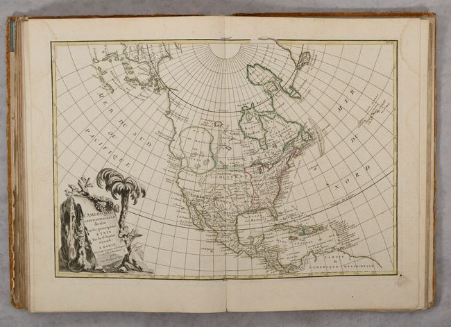
L'Amerique Septentrionale Divisee en ses Principaux Etats. This is one of the more interesting transitional states of this great 18th century map. The map was first issued in 1762 with an extensive network of rivers and lakes in present-day Canada that hinted at the possibility of a Northwest Passage. This edition, dated 1782, has been significantly re-engraved. The potential passage has been erased and a confused group of islands and notations about the Russian discoveries are now depicted in the region of Alaska. The salient feature is still the gigantic, and entirely mythical Sea of the West near modern-day Seattle, connected to the Pacific by the straits of Juan de Fuca and Martin d' Aguilar. New Albion is on the southwest shore of this great inland sea, which inundates virtually all of present-day British Columbia and Alberta. The new United States is formed east of the Mississippi, and French Louisiana stretches to the Pacific Northwest. Florida, Cuba and Nouveau Mexique are controlled by Spain. The large, decorative title cartouche incorporates a palm tree and grape vines.
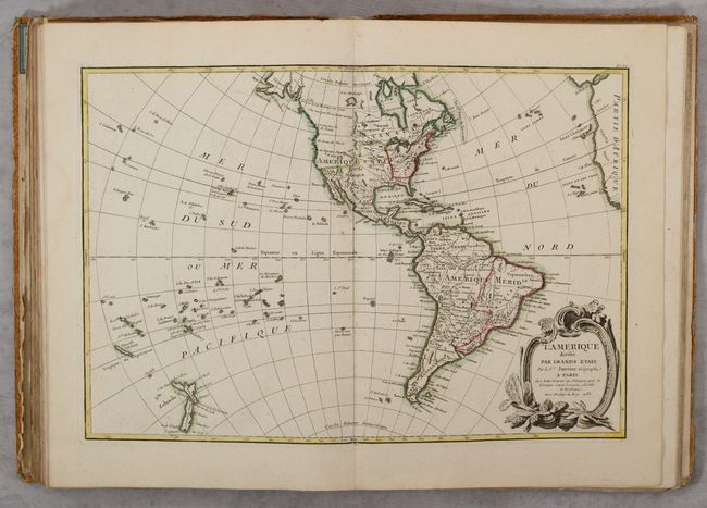
L'Amerique Divisee par Grands Etats. This map looks quite a bit different from the one above and is dated only one year later in 1783. A large Sea of the West that was on the earlier edition has now been removed. Alaska now is shown with approximately the correct shape, although the Aleutians are missing. New Zealand is fully formed, and there are many islands shown in the South Pacific. The map shows the infant United States with its western boundary on the Mississippi River. Spain controls all of the Southwest, Midwest, and Florida, and Britain possesses Canada and the Pacific Northwest.
Hardbound in paper covered boards.
References: McGuirk #109; cf. Sellers & Van Ee #93.
Condition: B+
Condition code is for the maps, which are mostly very good with an occasional spot of foxing and some light dampstains in the top corners that enter the map border of about half the maps. The world map has some creasing along the centerfold and a tear at bottom that enters 0.5" into the image. The large folding map of France has a 7.5" fold separation at lower right and a stamp on verso. Title page has scattered foxing and staining. Text block (excluding endpapers and publisher's advertisement) has separated from the binding, which is worn and abraded. Given the generally favorable condition of the maps, this atlas would be an excellent candidate for professional rebinding.