Catalog Archive
Auction 188, Lot 710

"Neue Geographische Vorstellung der Mitternaechtlichen Kuste von Africa…", Reinhardt, Andreas

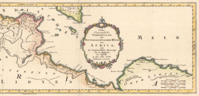
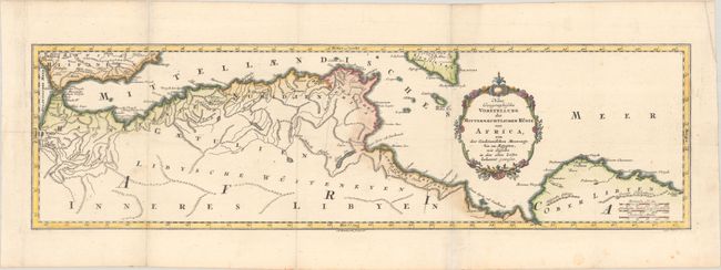
Subject: Northern Africa

Period: 1740 (circa)

Publication:

Color: Hand Color

Size:
23.3 x 6.5 inches
59.2 x 16.5 cm
Download High Resolution Image
(or just click on image to launch the Zoom viewer)

This lovely map of north Africa extends from the Strait of Gibraltar to Libya, and includes the southern tip of Spain and Sicily. Inland detail is limited to rivers, lakes, mountain ranges, and a few place names. A flaming Mt. Etna is depicted in Sicily. The map is adorned with a rococo-style title cartouche.

References:

Condition: B+

Issued folding, now pressed with several light printer's creases and a few unobtrusive spots.

Estimate: $140 - $170

Sold for: $70

Closed on 6/22/2022

Archived