Catalog Archive
Auction 188, Lot 664

"Carte Reduite des Detroits de Malaca, Sincapour, et de Gouverneur Dressee au Depost des Cartes et Plans de la Marine...", Bellin, Jacques Nicolas

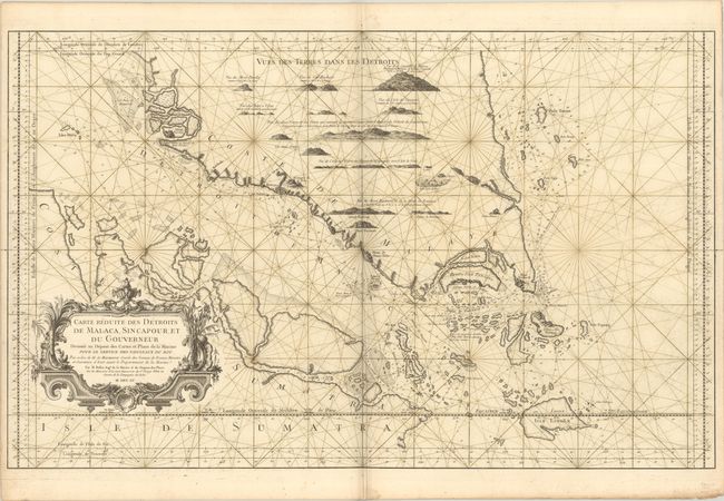
Subject: Strait of Malacca & Malaysia

Period: 1755 (dated)

Publication: L'Hydrographie Francoise

Color: Black & White

Size:
35.1 x 21.8 inches
89.2 x 55.4 cm
Download High Resolution Image
(or just click on image to launch the Zoom viewer)

This large chart focuses on the Strait of Malacca and the southern tip of Malaysia. Depth soundings, rocks, shoals and safe anchorages are identified. There are numerous islands depicted, with a note indicating that there are many tiny islands but they are not well known. The modern-day island of Singapore is labeled Pulo ou Isle Panjang. Land approach views fill the interior of Malaysia. The map is adorned with a decorative rococo cartouche.

References: Rumsey #12059.

Condition: B+

A dark impression on a sturdy sheet with a large double-headed eagle watermark, some printer's ink residue, an extraneous crease adjacent to the centerfold, marginal soiling, and rhumb lines skillfully added in brown manuscript ink. There is a grayish shadow along the centerfold that is caused by our scanner and doesn't appear on the map itself.

Estimate: $2,000 - $2,400

Sold for: $2,200

Closed on 6/22/2022

Archived