Catalog Archive
Auction 188, Lot 648

Early Map of Taiwan

"L'Ile de Formosa, ou sont Exactement Marquez les Bancs de Sables, Rochers et Brasses d'Eau...", Aa, Pieter van der
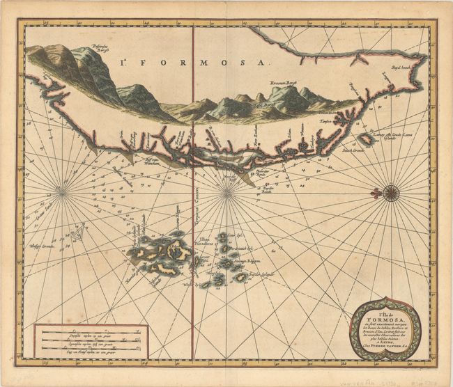
Subject: Taiwan

Period: 1720 (circa)

Publication: Galerie Agreable du Monde

Color: Hand Color

Size:
13.8 x 11.4 inches
35.1 x 29 cm
Download High Resolution Image
(or just click on image to launch the Zoom viewer)

This is one of the earliest, obtainable maps to focus on Taiwan. Oriented with north to the left, the map shows the southwestern portion of the island, as well as the adjacent Penghu Islands (Ilhas Piscadores). The detail is limited to a few place names along the coast and anchorages, shoals, and depth soundings in the surrounding waters. The interior of the island is filled with a large panoramic view of a mountain range.

References:

Condition: B+

Excellent impression on a bright sheet with a few small spots of foxing and minor toning.

Estimate: $1,400 - $1,700

Sold for: $1,400

Closed on 6/22/2022

Archived