Subject: Asia, Atlases
Period: 1652 (published)
Publication:
Color: Hand Color
Size:
7.5 x 10.2 inches
19.1 x 25.9 cm
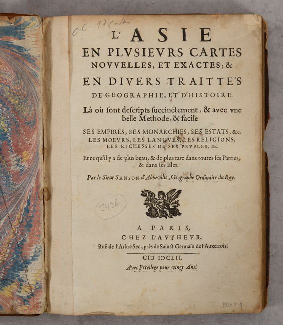
Nicolas Sanson was one of the foremost French cartographers of the 17th century, and is often considered as the "father" of French cartography. By around 1640, the French market in maps and atlases surpassed that of the Dutch, thereby initiating the Golden Age of French cartography. Born in Abbeville in December 1600, Nicolas Sanson was educated by the Jesuits in nearby Amiens. He studied history, and it is believed that he turned to cartography simply as a means to illustrate history. His maps soon came to the attention of Cardinal Richelieu, King Louis XIII's chief minister, and Sanson was asked to tutor the king in geography. Louis XIII later appointed Sanson "Geographe Ordinaire du Roy" (Geographer to the King). This appointment helped both expand and protect Sanson's role in the French map market. After a failed partnership with Melchoir Tavernier, an engraver and dealer of maps in Paris, Sanson began to edit and publish his work on his own. The most significant works that Sanson edited on his own were his quarto atlases of the four continents - L'Europe, L'Asia, L'Afrique, and L'Amerique - which he published beginning in 1647.
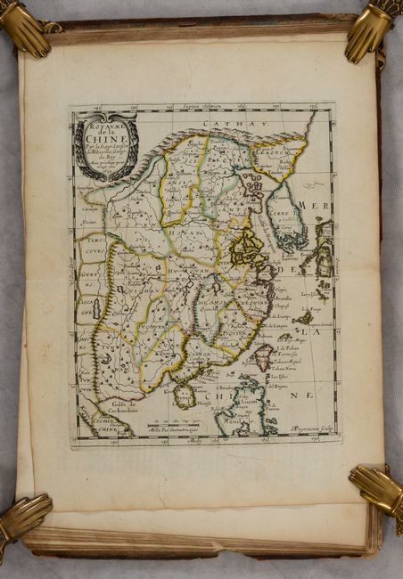
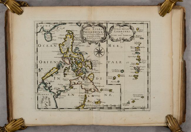
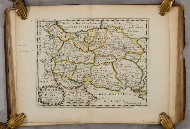
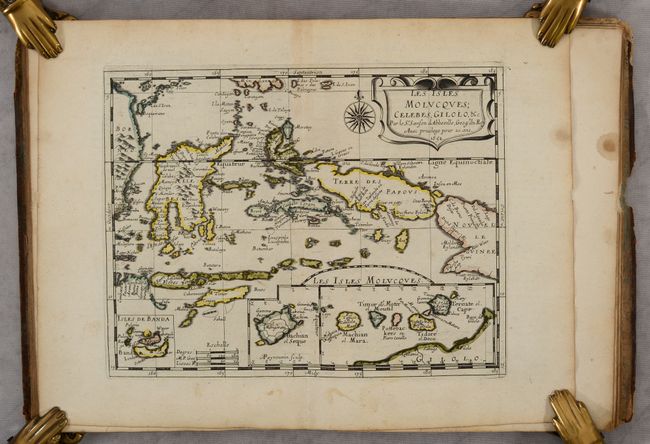
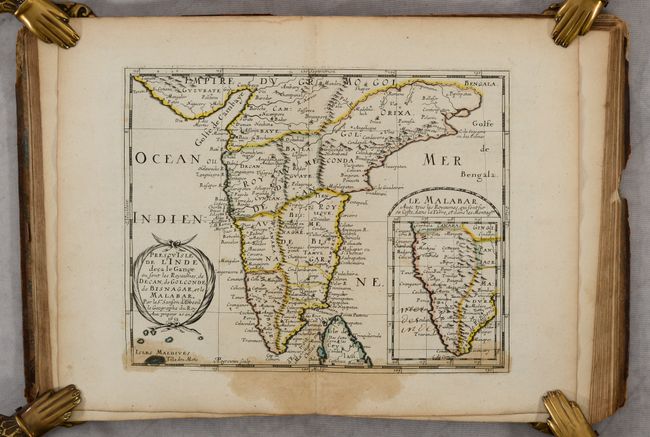
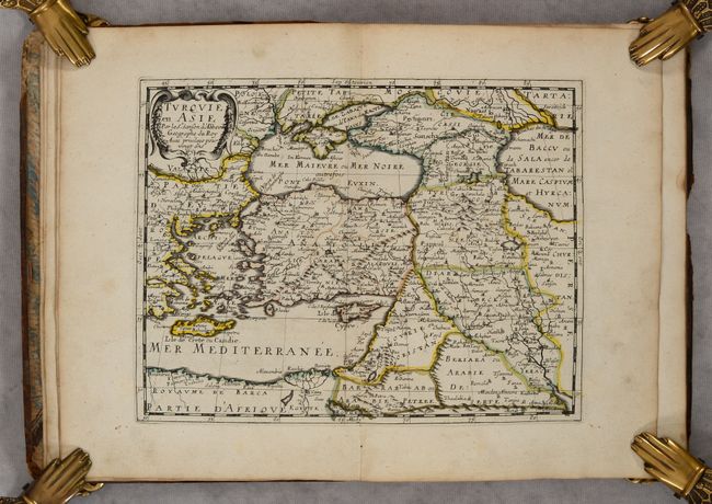
This is the first edition of Sanson's desirable atlas of Asia, with 17 maps accompanied by corresponding text. Sanson credits numerous sources for the maps and text, including the ancient geographers (Ptolemy, Pliny and Holy Scripture), the Arabs Al-Idrisi and Oulough Beg, the histories of explorers by Linschoten and Samuel Purchas, and the great Dutch cartographers of the 16th and early 17th centuries (Mercator, Hondius, Jansson, Blaeu and Visscher). Sanson also acknowledges the work of the Jesuits for his maps of China and Japan. The maps are: L'Asie, Turquie en Asie, Anatolie, Sorie, Turcomanie Georgie Commanie, L'Arabie, L'Empire du Sophy, L'Empire du Grand Mogol, Presqu'Isle de l'Inde deca la Gange, Partie de l'Inde audela du Gange, Royaume de la Chine, La Grande Tartarie, Description des Isles du Japon, Les Isles Philippines, Les Isles Molucques, Les Isles de la Sonde, and Ceylan et les Maldives. It is likely that all the maps were engraved by A. Peyrounin, as his imprint appears on 12 of the maps. This edition also includes a list of maps and publications offered by Sanson, as well as a page on Sanson's Privilege du Roi signed by the king's advisor, Renovard.
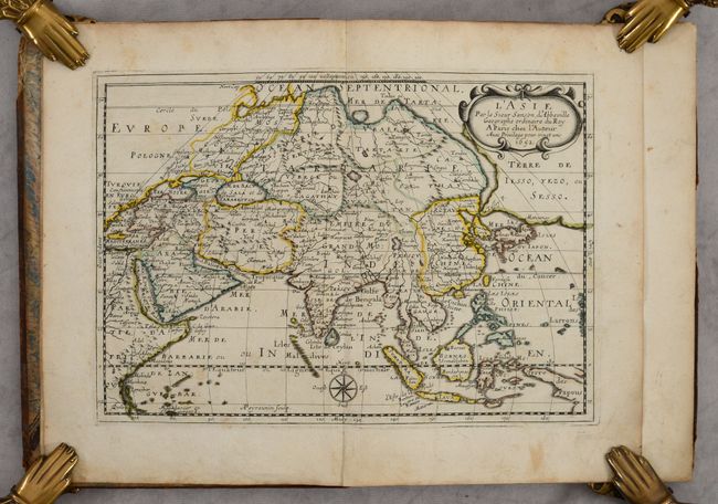
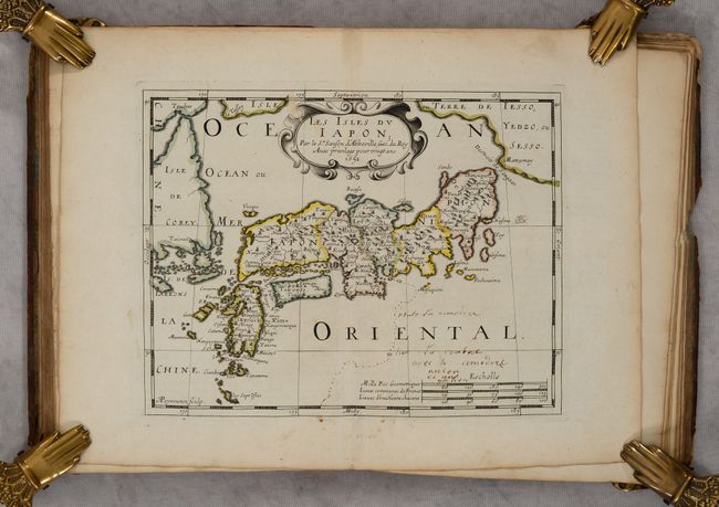
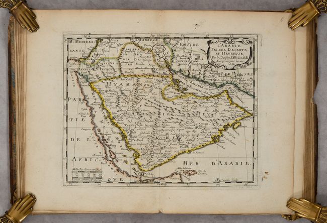
The map of Asia is important in the cartographic development of the region. It diverges from Sanson's folio map of 1650 in the appearance of a new landmass to the north of Japan labeled Terre de Iesso, Yezo ou Sesso. Sanson's depiction of this region is a combination of the reports of recent Dutch discoveries by De Vries and speculations of De Gama's discovery of a large landmass in the north Pacific. Japan is shown based on Jesuit sources and Korea is a globular-shaped island. There are four rivers flowing south out of the mythical Lac de Chiamay, which appears west of China. The map of Japan was based on Jesuit and Dutch cartographic sources and on the Dudley/Jansson model, and includes the coastline of Terre de Iesso Yedzo, ou Sesso at top right and the insular form of Korea at left. The map of Arabia is based on Sanson's folio-sized map of the region, with spurious mountain ranges and a distorted Red Sea, also named the Sea of Mecca (Mer de la Mecque).
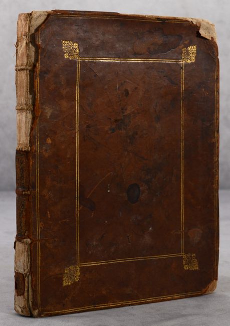
Small Quarto. Title page, 17 maps, 100 pp. text (unpaginated), 2 pp. advertisements, 1 page Privilege du Roi. Hardbound in contemporary calf with gilt tooling on covers and raised bands on spine.
References: cf. Ankary #61; Hubbard #25; Pastoureau, SANSON III A; Walter #OAG-26; Yeo #46.
Condition: B+
The maps are mostly in excellent condition (A) with a few in very good (B+) condition. The map of India has stains at the bottom of the map; the map of Japan has old manuscript ink notations in the image; the map and text for Southeast Asia have a dampstain at top center. There are some light dampstains affecting the last few pages of the volume, mostly confined to the blank margins. There are old manuscript ink scribbles on the verso of the title page, verso of the map of Europe, and the front and back pastedowns. The last page in the volume (Privilege du Roi) is torn in the center. Covers are soiled and rubbed with heavily bumped corners, several chips in the leather, and the leather partially detached on back cover. Most of the spine is missing.