Subject: Mediterranean Islands
Period: 1652 (circa)
Publication: Accuratissima Orbis Antiqui Delineatio…
Color: Hand Color
Size:
19.4 x 16.9 inches
49.3 x 42.9 cm
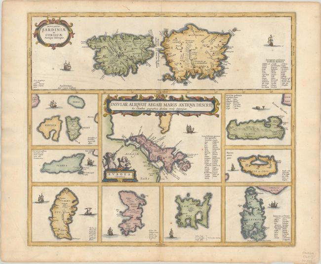
This sheet contains several maps of Mediterranean islands in classical times, all based in part on Ortelius. The central map [Euboea Insula] describes the Greek island Euboea and is surrounded by nine maps of other islands. This composition includes the islands of Sardinia and Corsica [Insularum Sardiniae et Corsicae Antiqua Descriptio] at top instead of Cyprus, as on Ortelius' map. Each shows tiny villages, rivers and mountains in profile and is decorated by sailing ships, except for Samos, which is adorned with a sea monster. Blank verso with manuscript number 35 on verso, published between 1652-84. First issued in Georgius Hornius' Accuratissima Orbis Antiqui Delineatio, which included maps from Johannes Jansson's historical atlas and Abraham Ortelius' Parergon.
References: Van der Krogt (Vol. I) #7500H:1; Zacharakis #1124.
Condition: A
There is minor toning, a few small spots, and centerfold separations at top and bottom that just cross the neatline and have been closed on verso with archival materials.