Subject: Eastern Europe, World War II
Period: 1943 (dated)
Publication:
Color: Printed Color
Size:
33.5 x 45.6 inches
85.1 x 115.8 cm
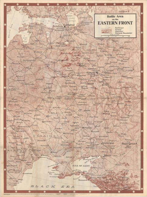
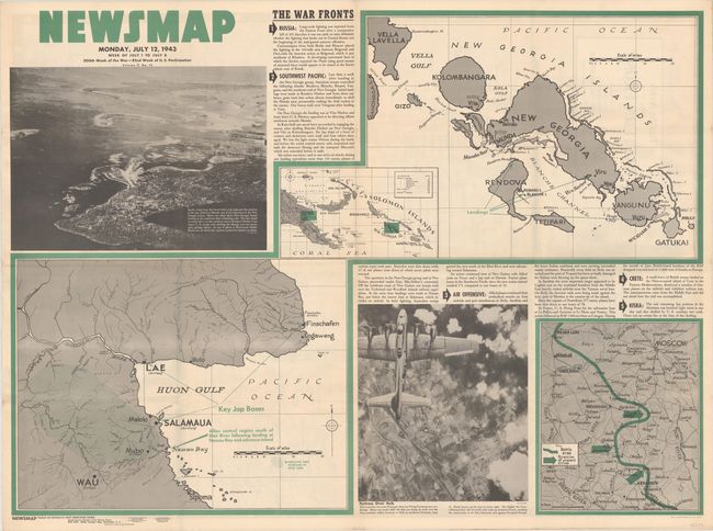
This large-format map depicting the Eastern Front extends from Finland south to Romania and east to the Soviet Union. Larger cities are depicted with a legend further indicating railroads, rivers, marshes and political boundaries. The map was issued on the verso of the "Newsmap" for Monday, July 12, 1943 which covered the news from July 1-8, 1943 - the 200th week of the war. This issue contains brief text related to the war fronts and two maps on recto highlighting eastern New Guinea and the New Georgia Islands. Augmenting the maps are two photographic illustrations showing Allied air raids conducted that week. Prepared by the Army Orientation Course and issued by the U.S. Government Printing Office.
From 1942-46, the U.S. Army published "newsmaps" to keep American troops updated on the war. These weekly posters were distributed and posted in every American installation in the world and were intentionally more visual than descriptive to help engage and motivate personnel.
References:
Condition: A
Issued folding with minor soiling and a short fold separation confined to the left blank margin.