Subject: Central Germany
Period: 1609 (circa)
Publication: Theatrum Orbis Terrarum
Color: Hand Color
Size:
17.9 x 13.5 inches
45.5 x 34.3 cm
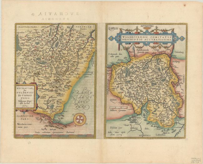
A pair of nice maps on a folio sheet, each with their own margins and cartouches. Both have charming pictorial depictions of cities and topography. Buchaviae sive Fuldonesis... is a map of the Fulda region from the 1574 map by Wolfgang Regerwyl. It is centered roughly on Fulda with Hammelburg near the bottom of the map, and oriented with north to the right corner by a compass. Waldeccensis Comitatus… describes the region around Waldeck, centered on Korbach with Waldeck beneath and to the right. Warsburg is in the top of the map and Frankenberg is in the bottom. Ortelius based the cartography on a six-sheet map by Joist Moers in 1572. Each map measures 8.6 x 12". Spanish text on verso, published in the 1609, 1612, and 1641 editions.
References: Van den Broecke #98.
Condition: A
Excellent impression and color on a sheet with a horn watermark. There is one tiny centerfold separation at top that has been professionally repaired.