Subject: France & Germany
Period: 1712-58 (circa)
Publication:
Color: Black & White
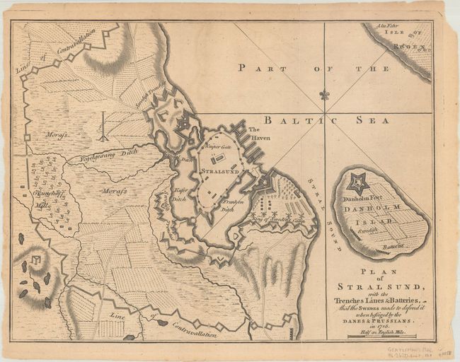
A. Plan of Stralsund, with the Trenches Lines & Batteries, That the Swedes Made to Defend It When Beseiged by the Danes & Prussians. In 1715, by Anonymous, from Gentleman's Magazine, circa 1758 (10.0 x 7.6"). A nice copper engraved map of the fortification of Stralsund and Danholm Island in northern Germany. The map depicts the fortification of the Swedish King against the Danes and Prussians in 1715. Reference: Jolly #GENT-120. Condition: Issued folding with light toning, minor offsetting, and a few short fold separations that have been closed on verso with archival tape.
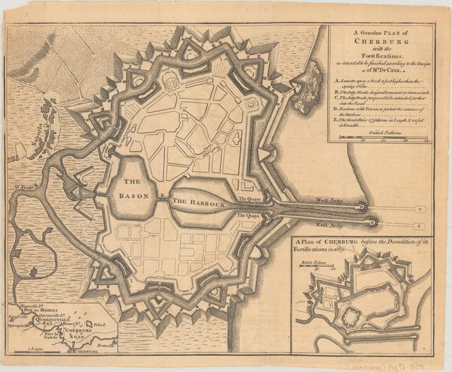
B. A Genuine Plan of Cherburg with the Fortifications. As Intended to be Finished According to the Design of Mr De Caux, by Anonymous, from Gentleman's Magazine, circa 1758 (9.9 x 7.7"). This is a bird's-eye plan of Cherbourg, located in northern France along the English Channel, showing the design of the plan to fortify the city. A legend details bastions, jetty heads, towers and a lunette to be positioned "upon a Rock 3 feet higher than the Spring Tides." The inset at right depicts a plan before the demolition of its fortifications in 1689. A smaller inset at left shows the region surrounding Cherbourg. Reference: Jolly #GENT-119. Condition: Issued folding with light toning, minor offsetting, and a few short fold separations that have been closed on verso with archival tape. Narrow left margin.
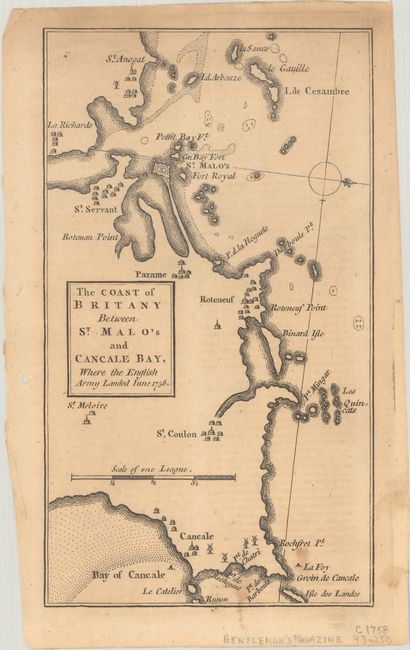
C. The Coast of Britany Between St. Malo's and Cancale Bay, Where the English Army Landed June 1758, by Anonymous, from Gentleman's Magazine, published 1758 (4.3 x 7.6"). Copper engraved map showing the villages along the coast. Reference: Jolly #GENT-117. Condition: Light toning with a few spots at lower right.
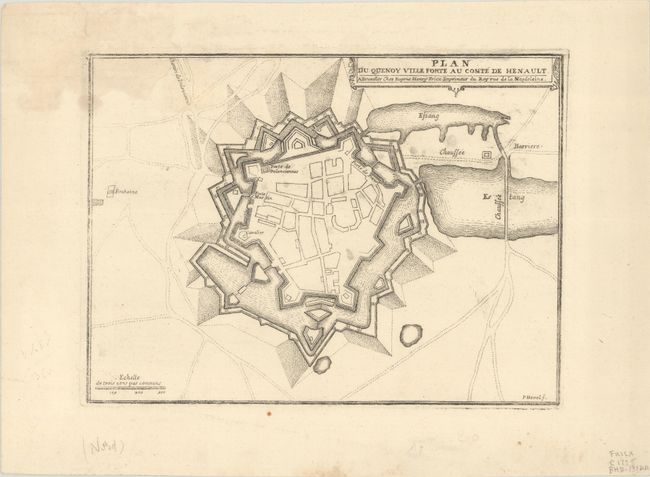
D. Plan du Quenoy Ville Forte au Comte de Henault, by Eugene Henri Fricx, circa 1712 (9.5 x 7.1"). Engraved by Pieter Devel. This is a bird's-eye plan of the fortified city of Quesnoy, just south of Valenciennes in northern France. Condition: There are a few small spots and a light damp stain at top left.
References:
Condition: B
See description above.