Subject: Baltic
Period: 1660 (circa)
Publication:
Color: Hand Color
Size:
21.3 x 17.8 inches
54.1 x 45.2 cm
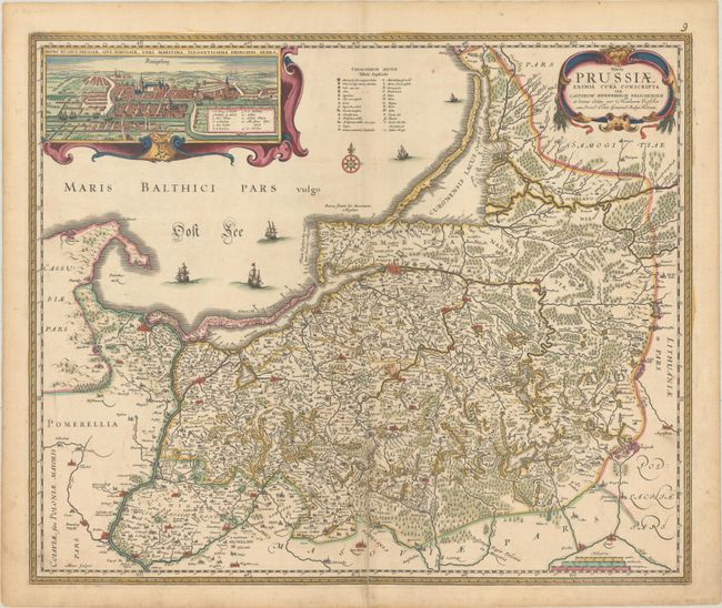
This uncommon and handsome map of Prussia includes Kaliningrad and parts of Poland and Lithuania. It includes a large inset bird's-eye view of Konigsberg with a legend that identifies 13 important buildings. Scores of towns and cities are identified, and there is exceptional detail of the region's watershed. It is based on an original map by Caspar Hennenberger (1529 -1600), the Prussian Lutheran pastor and cartographer who published the first detailed map of Prussia in 1576. The map is embellished with five ships in the Baltic and a decorative title cartouche. Engraved by Abraham Goos. This is the second state, with an alteration to Visscher's credit in the cartouche and no 1630 date next to Goos' imprint.
References:
Condition: B+
A crisp impression with contemporary color. There is a 7.5" centerfold separation at bottom that has been closed on verso with archival materials and minor soiling mostly in the margins.