Catalog Archive
Auction 188, Lot 405

"La Norvegia Divisa nelle sue Provincie di Nuova Projezione", Zatta, Antonio

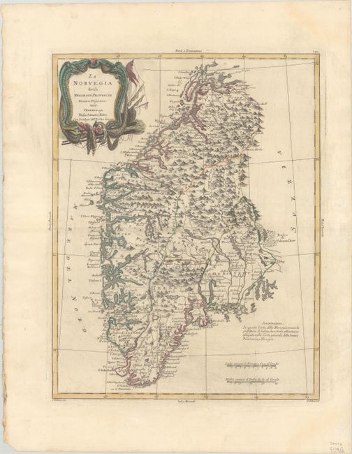
Subject: Southern Norway

Period: 1781 (dated)

Publication: Atlante Novissimo

Color: Hand Color

Size:
12.2 x 15.7 inches
31 x 39.9 cm
Download High Resolution Image
(or just click on image to launch the Zoom viewer)

This handsome and detailed Italian map covers southern Norway. It is fully engraved to show the rugged terrain, many fiords, and inland waterways. As noted in his Annotazione the Prefecture of Salten in northern Norway is not included because it was delineated on Zatta's general map of Scandinavia. The map is decorated with a nautical-themed title cartouche. Engraved by G. Zuliani, with lettering by G. Pitteri.

References: Ginsberg (Scandia) #62; Shirley (BL Atlases) T.ZAT-1a, Vol. 2 #29.

Condition: A

On watermarked paper with contemporary color and a bit of printer's ink residue. There is light dampstaining confined to the blank margins.

Estimate: $200 - $230

Sold for: $120

Closed on 6/22/2022

Archived