Subject: Eastern England
Period: 1831 (dated)
Publication: Atlas of the Counties of England
Color: Hand Color
Size:
27.5 x 23.5 inches
69.9 x 59.7 cm
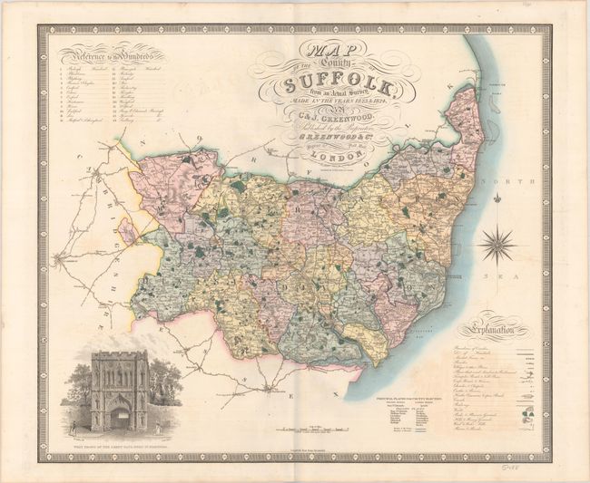
This impressively detailed steel engraved map of Suffolk is the work of the Greenwood brothers, Christopher and John. Beginning in 1817, the Greenwoods embarked on an ambitious project to survey the counties of England and Wales, with the aim of producing a series of maps of the region at a one-inch scale. Although their outsized goals were tempered by competition from the likes of the Ordnance Survey and fellow surveyor Andrew Bryant, they nonetheless produced numerous large-scale folding maps of the counties. Their Atlas of the Counties of England, published in 1834, collected their maps of England, each decorated with a vignette displaying a notable building in the area.
The Greenwoods' map of Suffolk divides the county into 24 Hundreds and shows market towns, parishes, villages, turnpike roads, churches, castles, canals, railways, woods, parks, hills, wind and water mills, rivers, and more. A list of the Hundreds is located at bottom left. At bottom right is a lovely illustration of Chichester Cathedral. Engraved with brilliant attention to detail by H. Frost.
References:
Condition: B+
Full contemporary color on a sturdy, watermarked sheet with light offsetting.