Subject: British Islands
Period: 1610 (dated)
Publication: The Theatre of the Empire of Great Britaine
Color: Hand Color
Size:
20 x 15.1 inches
50.8 x 38.4 cm
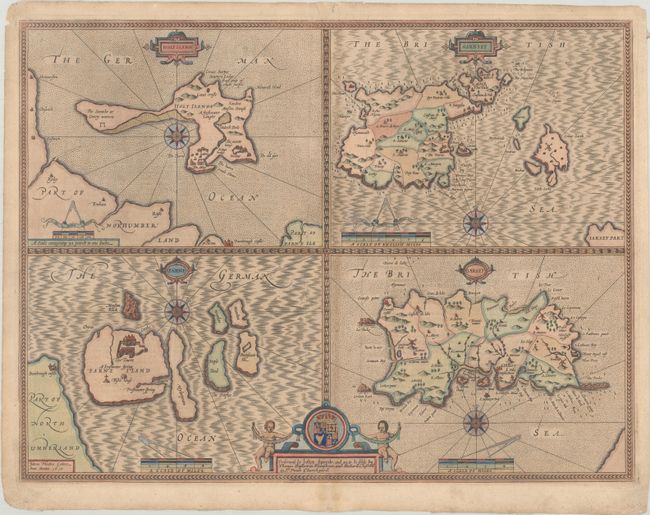
This folio sheet has four maps finely engraved by Jodocus Hondius for Speed in 1610 as noted in the imprint at lower left. The islands of Holy Island and Farne (Lindisfarne), off the Northumberland coast are shown at left, and at right are Guernsey and Jersey. The islands are described in English text on verso. Each map is embellished with a compass rose and cartouches for title and distance scale. At the bottom, the cartouche includes the coat of arms with two cherubs and the imprint of Bassett and Chiswell, indicating that it was published in 1676. English text on verso.
References: Shirley (BL Atlases) T.SPE-1k #68.1-68.4.
Condition: B+
A crisp impression on a lightly toned sheet with a fleur-de-lis watermark and lovely later color with gilt and silver highlights. There is light soiling, a bit of offsetting along the centerfold, and archival repairs to a short edge tear at top, a few minute worm tracks along the centerfold, and along the top and bottom edge of the sheet.