Subject: Eastern Cuba
Period: 1877 (dated)
Publication:
Color: Black & White
Size:
37.6 x 23.8 inches
95.5 x 60.5 cm
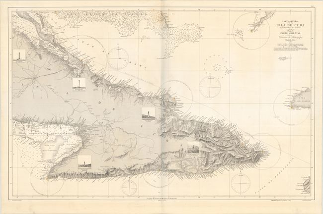
This highly detailed chart of eastern Cuba was published in Madrid. It spans from Puerto Principe (Camaguey) east to show fragments of Haiti and the Inagua Islands. Inland detail consists mostly of rivers, roads, and railways, but the coast is lined with place names and features rich topographical detail. The Great Bahama Bank, the Bahia de Nuevitas, and the Gulf of Guacanayabo are filled with depth soundings. Five lighthouses are depicted in vignettes peppered throughout the map, and the range of various lights is also shown. The price beneath the neatine is 3 pesetas. Drawn by J. de Lorenzo and engraved by M. Rodriguez, with lettering by J. de Gangoiti. The embossed seal of the Direccion de Hidrografia is at bottom left. Spanish sea charts are among the finest, and scarcest, of all working charts. They are uncommonly offered on the market.
References: Cueto #120.
Condition: B+
On sturdy watermarked paper with a light dampstain at top center and minor soiling. The lighthouses are colored in red and yellow, as is common on sea charts of this period.