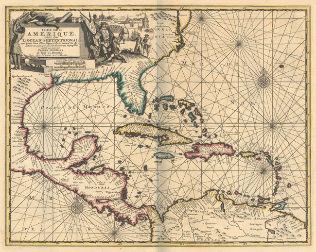
Subject: Gulf of Mexico & Caribbean
Period: 1735 (circa)
Publication:
Color: Hand Color
Size:
14.1 x 11.1 inches
35.8 x 28.2 cm
This scarce and skillfully engraved map focuses on the West Indies and extends from the Chesapeake Bay through the Gulf of Mexico to Central America and the northern part of South America. The map features excellent detail along the coastlines with numerous place names, capes, bays, and offshore islands identified. A pictorial title cartouche fills the interior of North America and depicts Native Americans trading with Europeans and a small view of Havana harbor in the background. The chart is further enhanced with compass roses and rhumb lines. Originally published by Van der Aa, this edition was sold by Covens & Mortier.
References:
Condition: A
Contemporary outline color on a sturdy sheet with wide original margins. There is some minor foxing mostly in the blank margins. The faint shadow along the centerfold is caused by our scanner and is not present on the physical map.