Subject: Tampa, Florida
Period: 1946 (dated)
Publication:
Color: Printed Color
Size:
16.1 x 18.6 inches
40.9 x 47.2 cm
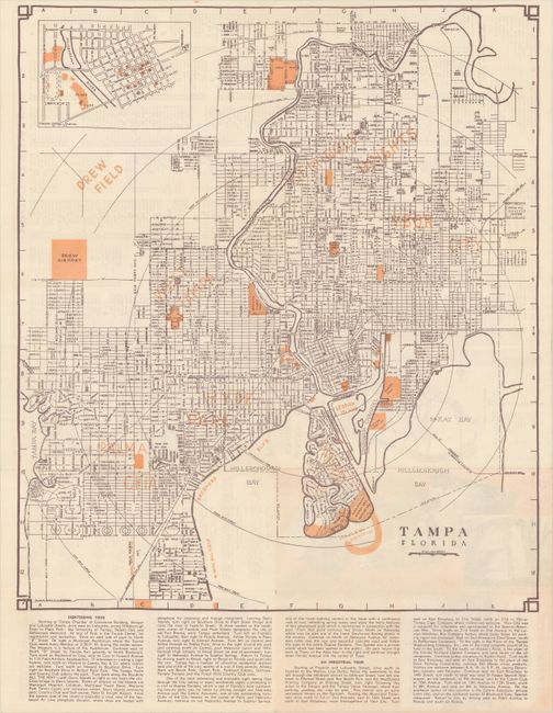
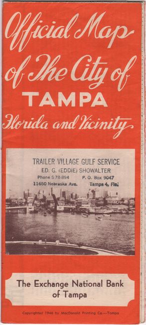
This detailed map showing the street-grid pattern of Tampa was copyrighted by the MacDonald Printing Company for the Exchange National Bank of Tampa. The map extends from Davis Islands north to Lowry Park with points of interest highlighted in orange overprinting including the Peter O. Knight Airport, Drew Airport and Drew Field, which the City of Tampa leased to the U.S. Army for use during World War II (Drew Airport would be renamed Tampa International Airport in 1950). Includes an inset of the downtown area at top left, and text at bottom describes both a sightseeing and industrial tour. A street index, small highway map, and related text are found on verso. Self-folding into pictorial paper wrappers (3.8 x 8.5").
References:
Condition: A
Issued folding on a clean sheet. There is a stamp on the front wrapper for "Trailer Village Gulf Service."