Subject: Tennessee, North Carolina, Virginia
Period: 1968-70 (dated)
Publication:
Color: Printed Color
Size:
33.3 x 21.2 inches
84.6 x 53.8 cm
Two pictorial bird’s-eye views by the Missouri Map Company, a short-lived map publisher established in 1965 and dissolved in 1970:
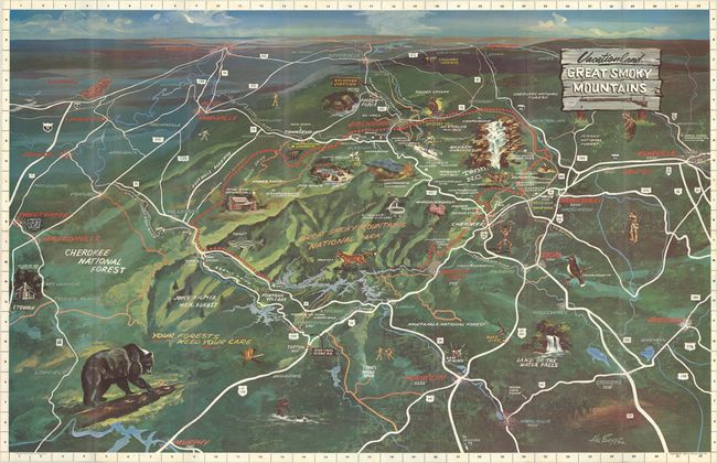
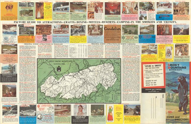
Vacationland Great Smoky Mountains. This view was drawn by Hal Boyer and is centered on the Great Smoky Mountains National Park. The map features well-rendered topography and is filled with illustrations showing the recreational opportunities in the area including hiking, fishing, and skiing. A large menacing black bear occupies the lower left corner with other wildlife shown throughout. The verso contains a detailed map of the park along with text and numerous advertisements. Self-folds into pictorial wrappers (4.5 x 11.0"). Only one institutional copy is noted on OCLC (Library of Congress).
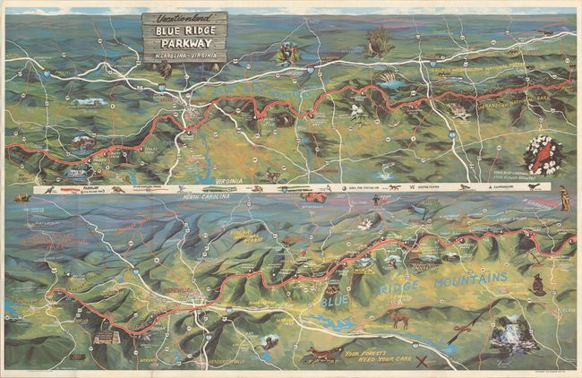
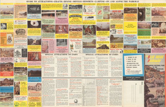
Vacationland Blue Ridge Parkway N. Carolina-Virginia. This sheet contains two panoramic sections of the Blue Ridge Parkway, extending from Front Royal, Virginia to the Cherokee Indian Reservation west of Asheville, North Carolina. The flora, fauna, and points of interest are well represented throughout by illustrator "Pool Tampa." The verso is filled with related text and advertisements. Self-folding (4.3 x 11.0") in pictorial wrappers. No examples located on OCLC.
References:
Condition: A
Clean and colorful examples, issued folding. The Blue Ridge Parkway map has a tiny edge tear confined to the bottom blank margin.