Subject: Colonial Northeastern United States & Canada
Period: 1745 (dated)
Publication:
Color: Black & White
Size:
24.1 x 18.8 inches
61.2 x 47.8 cm
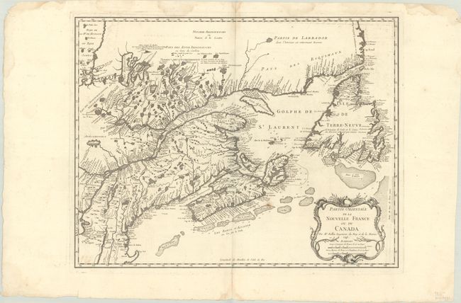
This is the rare second state of Bellin's definitive map of eastern Canada and New England covering the course of the St. Lawrence River, the Maritime provinces, and French claims in the region. Numerous towns and settlements are identified along the Atlantic coast including Havre de Baston for Boston Harbor, Portsmouth in New Hampshire, Wells, York and Cape Elizabeth in Maine. The interior is filled with rivers, lakes and notations reflecting the extent of French knowledge at the time. A large decorative cartouche at lower right incorporates two distance scales. Kershaw notes that this state has the "A Paris chez R.J. Julien a l'Hotel de Soubise..." imprint removed below the bottom neatline, but is essentially the same as the first state published earlier the same year. This important map of the region was copied by numerous cartographers in the second half of the 18th century.
References: Kershaw #688.
Condition: B+
A dark impression on a watermarked sheet with a small rust spot below Nova Scotia and some faint offsetting. There are several dampstains in the top blank margin, a few of which just touch the border.