Subject: Atlases
Period: 1794 (published)
Publication:
Color: Hand Color
Size:
9.6 x 12.1 inches
24.4 x 30.7 cm
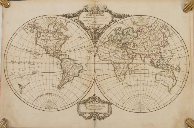
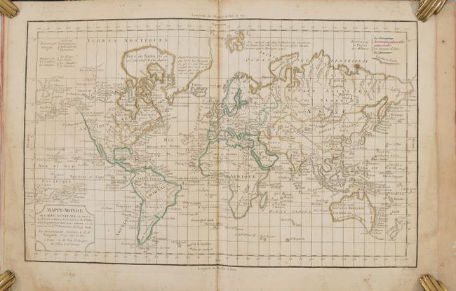
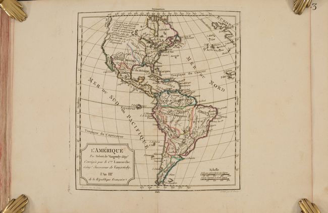
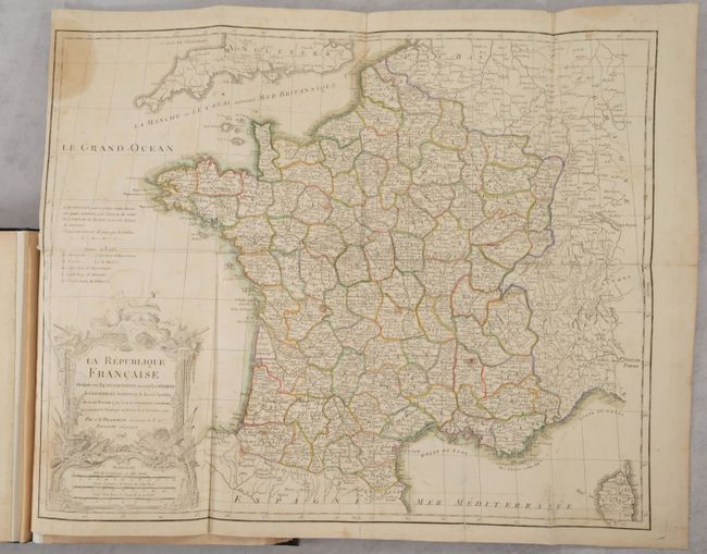
This atlas is complete with 53 double-page maps, and a bonus large folding map of La Republique Francaise that is not listed in the table of contents. The maps are preceded by a beautifully engraved title page and 7 preliminary pages that include a list of maps and an alphabetical index of place names. The atlas includes four world maps (showing the tracks of explorers including Capt. Cook), five related to the Americas, three of Africa, five of Asia, four of the Holy Land and the balance of Europe. The three world maps on Mercator's projection are identical except for color-coding to indicate different religions, skin color, and facial features in various regions around the world. Map number 47 has been used twice to depict the changes in political boundaries in the Middle East.
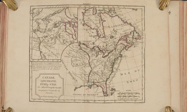
The map Canada, Louisiane, Etats-Unis is the uncommon third state of this map that first appeared in 1762. The title has been amended to acknowledge the new United States and to include the imprint of Delamarche. A large inset map covers the west coast and is most notable for its depiction of two remarkable cartographic misconceptions; a huge Mer de l' Ouest or Sea of the West and a Northwest Passage through a system of rivers and lakes connecting Hudson Bay with the Pacific based on the fictitious discoveries of Admiral de Font.
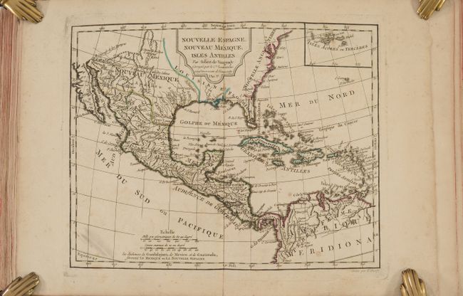
Another interesting map is Nouvelle Espagne, Nouveau Mexique, Isles Antilles, which focuses on the Gulf of Mexico and the Caribbean but also extends to include the southern part of North America through Central America and the northern part of South America. Detail is mostly confined to the Spanish possessions with a number of early missions and settlements named in Nouveau Mexique including Cenis in today's Texas. An interesting portrayal of Florida shows the tip consisting of several large islands. There is an inset map of the Azores at top right. The title appears within a decorative rococo-style cartouche at top.
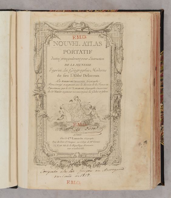
The Nouvel Atlas Portatif was Didier Robert de Vaugondy's only independent atlas venture, without any financial backing from others. It was designed specifically for educating young students, and is prefaced with "Discours sur l'etude de la Geographie," in which he laid out his philosophy of teaching children geography. It was first published in 1762, with subsequent editions through 1817.
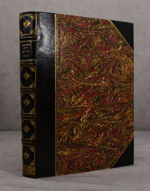
4to. Handsomely rebound in quarter leather with tips over marbled paper-covered boards with raised bands, gilt embossing and gilt title on spine.
References: Pedley, pp. 97-102, 231; Shirley (BL Atlases) T.ROBV-2a.
Condition: B+
The maps have nice impressions and contemporary outline color with light soiling and occasional toning. There is a dampstain in the bottom right corner that affects the first 12 maps, entering the image only on the 4 world maps. There are 6 maps that are in "B" condition: the 4 world maps (due to the dampstain), the map of northern South America (toning and scattered foxing), and the large folding map of France (light soiling, dampstaining along the left side, and an archivally repaired tear that enters 3" into the map at bottom left). The title page has dampstaining in the margins, light soiling, old manuscript ink notations, and several red "F.M.O" stamps. The new binding is in excellent condition and has very minor wear.