Subject: Southern Asia
Period: 1616 (published)
Publication: Tabularum Geographicarum Contractarum…
Color: Black & White
Size:
5.3 x 3.7 inches
13.5 x 9.4 cm
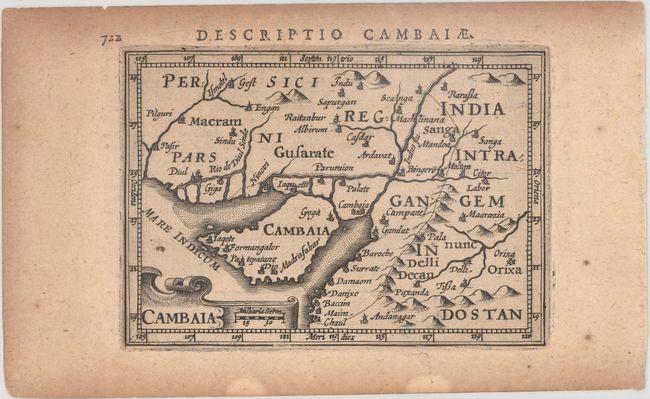
A. Cambaia. Charming miniature map of the region encompassing the modern-day border between India and Pakistan and the Indus River valley. The strapwork cartouche encloses the title and distance scale. Latin text on verso.
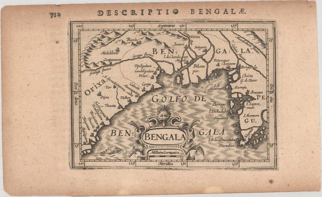
B. Bengala. Charming miniature map of the northern part of the Bay of Bengal, which includes parts of northeastern India, Bangladesh and Burma. Locates and names numerous towns, with rocks and shoals noted offshore. Nicely engraved map featuring a strapwork-style cartouche and a sea monster. Latin text on verso.
References: King (2nd ed.) pp. 96-99; Van der Krogt (Vol. III) #8310:342 & #8340:342.
Condition: B+
Dark impressions with light toning that is heavier along the edges of the sheets. There are small damp stains along the bottom edge of the sheets.