Subject: China & Korea
Period: 1700 (circa)
Publication:
Color: Hand Color
Size:
20.6 x 18.4 inches
52.3 x 46.7 cm
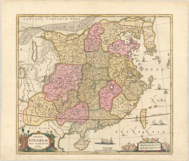
This superb map of the Chinese Empire is drawn largely from the Blaeu map compiled by Jesuit Father Martino Martini who traveled through the region between 1643 and 1650. It deviates from that model in its depiction of the Korean peninsula, which is shown with a cluster of islands at its southern tip. The map is embellished with sailing ships and Chinese junks. The title cartouche is flanked by Chinese and Jesuit men and the scale of miles cartouche is surrounded by putti. Engraved by Johannes van Loon and first issued by Jan Jansson in his Atlas Novus in 1657. Old manuscript text on verso.
References: Van der Krogt (Vol. I) #8410:1C.
Condition: B+
Bold contemporary color in the map with later color in the decorative elements, on a bright sheet with a few faint spots of foxing and a bit of show-through of the manuscript text on verso.