Subject: Middle East & Cyprus
Period: 1564 (circa)
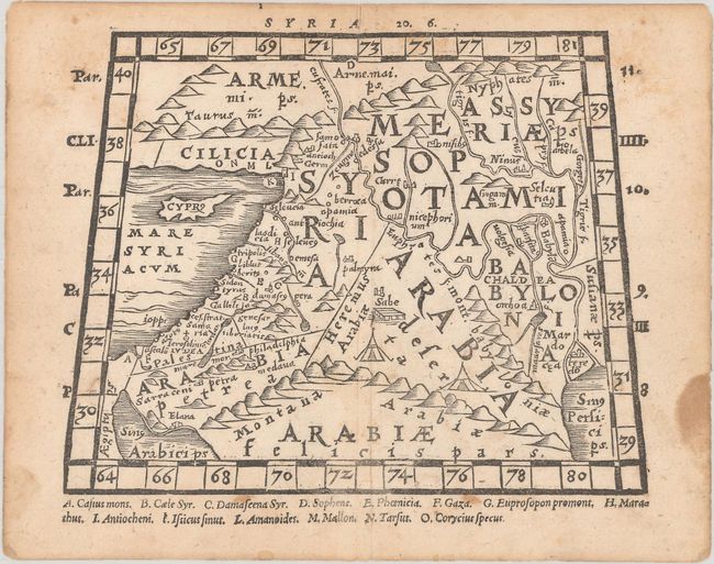
Publication: Pomponii Melae Philosophi Celeberrimi de Orbis Situ...
Color: Black & White
Size:
6.3 x 4.9 inches
16 x 12.4 cm
This classical woodblock miniature map of the Middle East comes from an edition of Pomponius Mela's geography with maps provided by Heinrich Petri, first published in 1564. The trapezoidal map covers the region from the Eastern Mediterranean (with Cyprus prominently shown) to the Persian Gulf, and from southern Turkey to the Red Sea. There are rivers, rope-like mountain ranges, ancient place names, and large tents in the desert. A key across the bottom identifies 14 sites of interest, including Damascus and Gaza.
References: Shirley (BL Atlases) G.MELA-1a #2.
Condition: B+
There is light scattered foxing, a short centerfold separation in the upper margin, and a dampstain along the right edge, well away from map image.