Subject: Central Europe, Germany
Period: 1571 (published)
Publication: Theatrum Orbis Terrarum
Color: Black & White
Size:
20 x 14.4 inches
50.8 x 36.6 cm
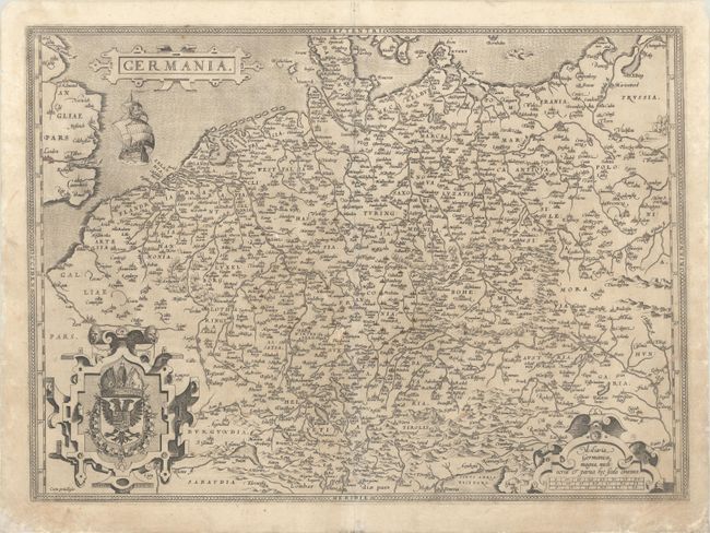
Elegant map of the German Empire, which at the time included the Netherlands and Belgium, stretching from Calais to the Wista River in present day Poland, and south to the Adriatic Sea. Ortelius based this beautiful map on Christiaan Sgrothen's map of 1565. The title is enclosed is a strapwork cartouche, below which sails a large ship, and two large cartouches incorporate the royal coat of arms and scale of miles. Latin text on verso.
References: Van den Broecke #56.
Condition: B+
An early impression with a number of cities highlighted in old color, on a sheet with a coat of arms watermark and light soiling. There are professional repairs to a few small worm holes in the image, a short centerfold separation at bottom, and some small chips and tears along the edges of the sheet.