Subject: Ancient World
Period: 1650 (circa)
Publication:
Color: Hand Color
Size:
20.1 x 15.9 inches
51.1 x 40.4 cm
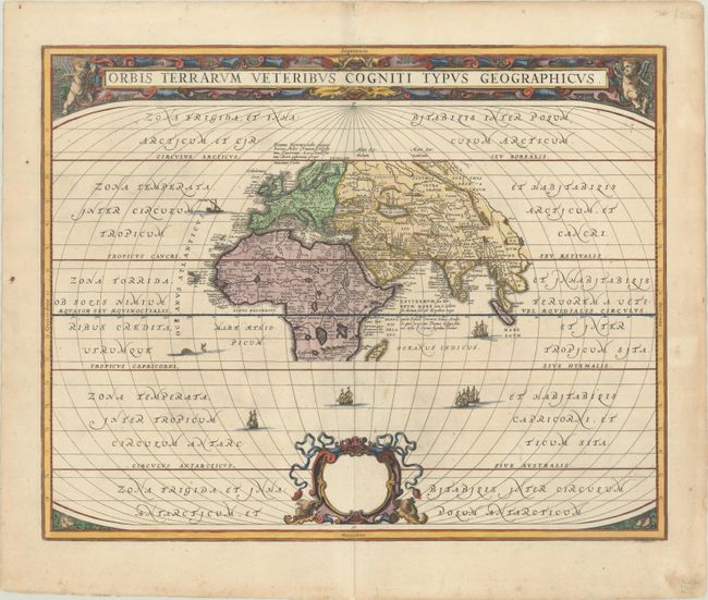
A classic map of the ancient world based on Ortelius. Europe, Asia, and Africa as far south as Madagascar are centered in a wide oval frame. The climatic zones are marked, and ships and sea creatures surround the map. The title is enclosed in a strapwork panel at top. This is the first state of the map with a blank dedication cartouche at bottom. Blank verso.
References: Shirley #385; Van der Krogt (Vol. I) #0800H:1.1.
Condition: A
A sharp impression on a bright sheet with light toning along the edges of the sheet and archival repairs to centerfold separations at top and bottom and to a few tiny chips and tears along the edges of the sheet.