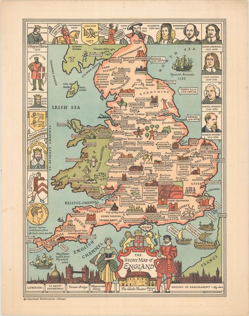
Subject: England & Wales
Period: 1943 (dated)
Publication:
Color: Printed Color
Size:
11.1 x 15 inches
28.2 x 38.1 cm
This charming pictorial map gives an overview of the history of England and Wales. Major cities are located, some of which include images of important buildings and structures, such as Stonehenge and Windsor Castle. Famous London buildings are shown at bottom, alongside the title cartouche, a maiden and a Yeoman Warder. The partial border incorporates portraits of important people in British history, including Afred the Great, Elizabeth I, Shakespeare, and Charles Dickens. Created by Egbert G. Jacobsen and published in Chicago by Colortext Publications, which created a series of Story Maps between 1935-50.
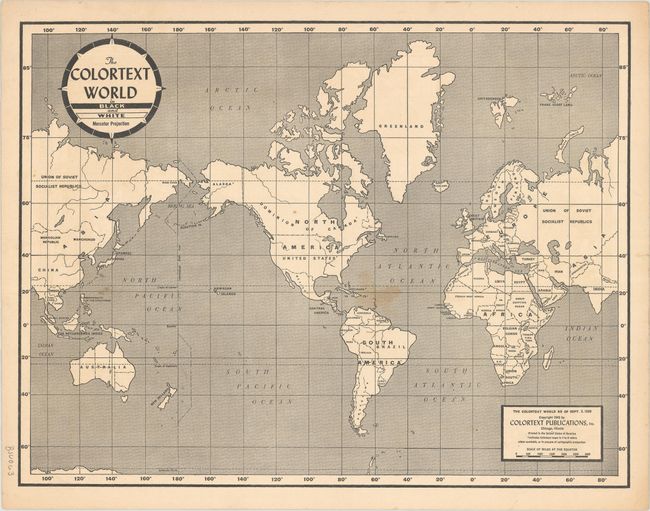
On verso is The Colortext World in Black and White Mercator Projection, which shows the world as of September 3, 1939, with countries marked with an asterisk indicating that maps of that country are available through Colortext Publications, Inc.
References: cf. Rumsey #10018.
Condition: A
A bright example with minor marginal soiling, a short tear in the top blank margin, and light soiling in the world map on verso.