Catalog Archive
Auction 187, Lot 389

"Les Royaumes d'Angleterre d'Escosse et d'Irlande avec Partie de la France et des Pay Bas", Leth, Hendrik de
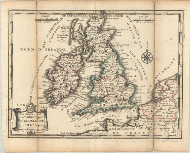
Subject: Britain

Period: 1740 (circa)

Publication: Nouvel Atlas Geographique & Historique...

Color: Hand Color

Size:
8.6 x 6.4 inches
21.8 x 16.3 cm
Download High Resolution Image
(or just click on image to launch the Zoom viewer)

A lovely, small map of England, Wales, Scotland and Ireland with a portion of the coastline of France and the Netherlands. The map is quite detailed for its small size and is decorated with a drape-style cartouche. For his Nouvel Atlas, Leth made close copies of Jacques Chiquet's maps published in Le Nouveau et Curieux Atlas in 1719.

References: Shirley (BL Atlases) T.LETH-1a.

Condition: B+

A dark impression with contemporary outline color, issued folding with light toning along the folds and fold separations that have been repaired with paper on verso.

Estimate: $110 - $140

Sold for: $80

Closed on 4/27/2022

Archived