Subject: Peru
Period: 1622 (published)
Publication: Novus Orbis, sive Descriptio Indiae Occidentalis
Color: Black & White
Size:
11.6 x 8.5 inches
29.5 x 21.6 cm
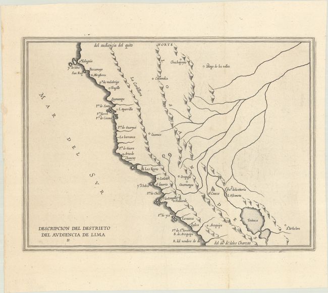
Antonio de Herrera Y Tordesillas was the official historian of Spain and the Indies. He compiled a history of the Spanish conquests and early explorations in the Americas, which included this simply engraved map of Peru. His work (Historia General de los Hechos de los Castellanos) was originally published in 1601 with several editions and translations thereafter, all of which are scarce. This is one of the earliest maps to include information from the manuscript maps of Juan Lopez de Velasco, a Spanish cosmographer. Caxamalca (Cajamarca), where Atahualpa was captured by Pizarro is shown to the north, and Guamanga (Ayacucho) and Cusco are located between the Eastern and Western Cordilleras of the Andes. Although simply engraved, it is a nice example of scarce Spanish cartography.
References: Shirley (BL Atlases) G.HERR-2c.
Condition: A
A fine impression on a sheet with a Strasbourg Lily watermark. There is minor offsetting and a small worm track in left blank margin that has been professionally infilled. Remnants of hinge tape on verso.