Subject: Brazil, Paraguay, & Uraguay
Period: 1798-1821 (dated)
Publication:
Color: Hand Color
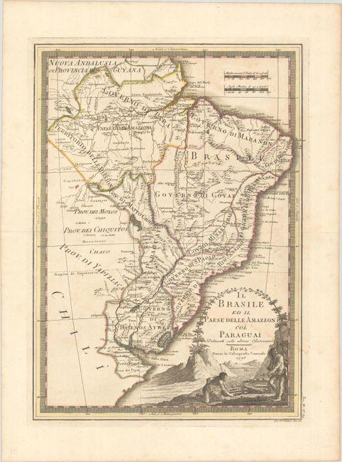
A. Il Brasile ed il Paese delle Amazzoni col Paraguai Delineati sulle Ultime Osservazioni, by Giovanni Maria Cassini, from Nuovo Atlante Geografico Universale, dated 1798 (13.8 x 19.0"). This is an uncommon Italian map of Brazil, Paraguay, and Uraguay. It extends to include the vicinity of Buenos Aires. It provides a good amount of detail including extensive river systems. The large landscape style title cartouche features Native Americans tending a fire. Condition: A crisp impression with contemporary outline color on a watermarked sheet. There is light dampstaining and some light toning.
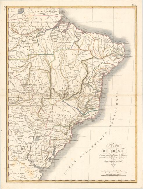
B. Carte du Bresil, Dressee pour l'Intelligence de l'Histoire Generale des Voyages de Laharpe, by Ambroise Tardieu, from Atlas pour Servir a l'Intelligence de l'Histoire Generale des Voyages, de Laharpe, dated 1821 (15.8 x 21.3"). This French atlas map divides Brazil into its provinces and includes nice topographical detail and plenty of place names. It extends as far south as Buenos Aires and the mouth of the Rio de la Plata. It shows all of Paraguay. Uruguay is not yet named; it would not declare independence from Brazil until 1825. Condition: A nice impression with areas of light scattered foxing.
References:
Condition: B+
See description above.