Subject: Guyana & French Guiana
Period: 1780-1850 (circa)
Publication:
Color: Hand Color
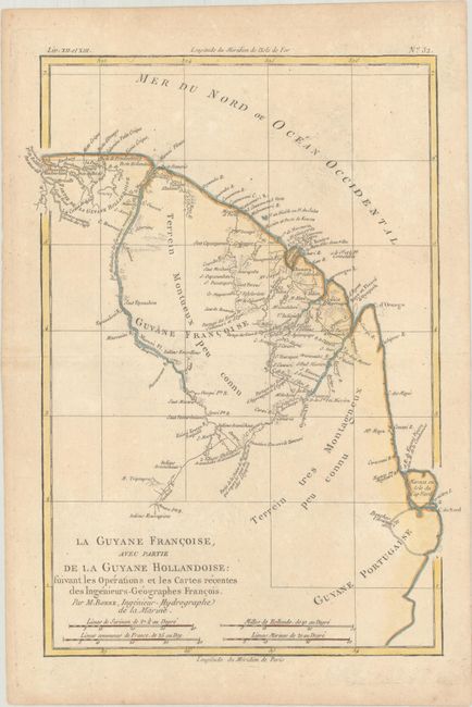
A. La Guyane Francoise, avec Partie de la Guyane Hollandoise: Suivant les Operations et les Cartes Recentes des Ingenieurs-Geographes Francois, by Rigobert Bonne, from Atlas Geographique, circa 1780 (9.3 x 12.7"). This map of French Guiana stretches from the Isla de Maraca in the south to past the Maroni River in the north. There is good detail of the rivers in the region, in addition to numerous coastal place names. Condition: On watermarked paper with minor soiling and a hint of offsetting near the centerfold.
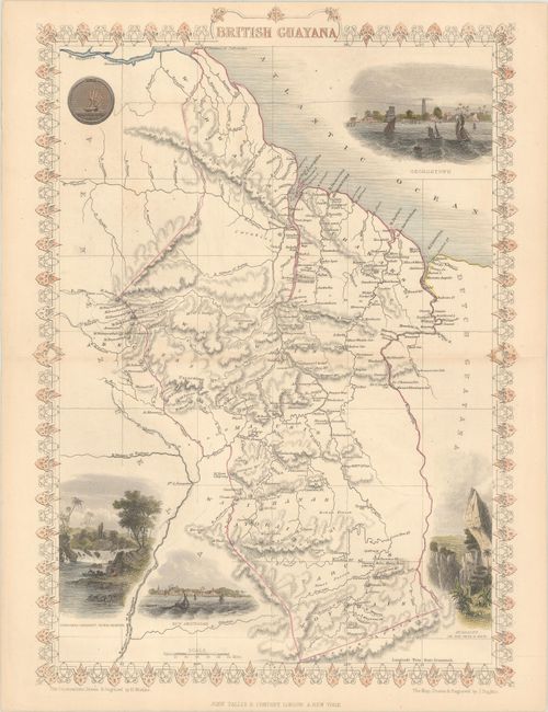
B. British Guayana, by John Tallis, from Illustrated Atlas and Modern History of the World, circa 1850 (9.8 x 13.8"). This handsome map spans from the mouth of the Orinoco to the Sierra Acarai (Serra da Acari) mountain range on the border of Guyana and Brazil. It includes the national seal and vignettes of Georgetown, Ataraipu or the Devil's Rock, New Amsterdam, and Christmas Cataract, River Berbice. The illustrations were drawn and engraved by H. Winkles; the map was drawn and engraved by J. Rapkin. Condition: Contemporary outline color with later color in the vignettes and border. There is faint toning along the centerfold and some unobtrusive pencil notations in the image.
References:
Condition: B+
See description above.