Subject: Barbados
Period: 1782 (dated)
Publication: Political Magazine
Color: Black & White
Size:
14.7 x 11.3 inches
37.3 x 28.7 cm
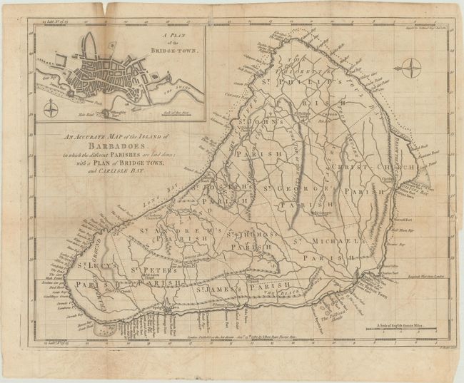
This rare map is based on William Mayo's important survey of the island between 1717 and 1721. Mayo's was the second systematic, and first large-scale, survey and it fixed the legal bounds of the parishes. It was not until the Admiralty survey of 1873 that Mayo's map ceased to be the standard representation for maps of Barbados. The map shows the eleven parishes and depicts the ports, settlements, forts, churches, and roads. At top left is an inset depicting a bird's-eye plan of Bridgetown. A compass rose orients north to the left. This map was published in the Supplement to the Political Magazine, and is thus quite uncommon.
References: Campbell (MCC-21) #43; Jolly #POL-43.
Condition: B
Issued folding, now flat, on a lightly toned sheet with two watermarks, one with a crown and the initials "GR." There is light dampstaining at top, light offsetting and soiling, and a fold split at top left that has been closed on verso with paper tape. At right, a binding trim and 2" associated tear have been also been closed with paper tape.