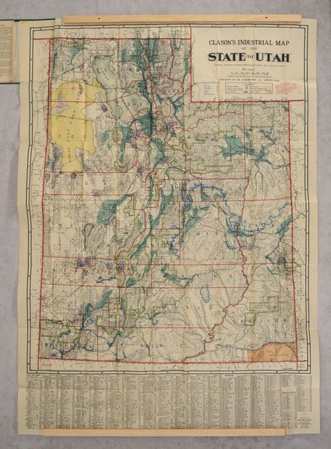
Subject: Utah
Period: 1908 (dated)
Publication:
Color: Printed Color
Size:
30.1 x 37 inches
76.5 x 94 cm
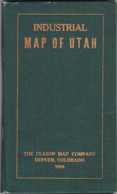
A very large and colorful map emphasizing the state's natural resources with geological data provided by Robert Forrester. A color-coded legend locates national forests, agricultural lands, coal deposits, and wagon roads with additional blue symbols indicating precious metals including gold, sliver and copper. One of the most elaborate Clason maps ever produced, even telephone lines have been noted. Features an index to cities and towns at bottom. Folds into green cloth boards (4.0 x 7.0") with gilt title on the front cover. We found no past sales records and only four institutional examples on OCLC.
References:
Condition: A
Clean and colorful, issued folding, with one short split at a fold junction with minor image loss. Covers have minor wear.