Subject: Austin, Texas
Period: 1926-55 (dated)
Publication:
Color:
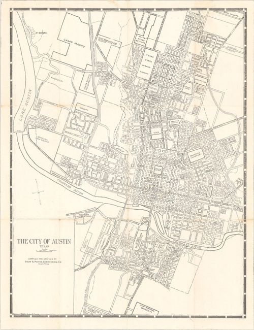
A. The City of Austin Texas, by Dixon B. Penick, dated 1926, black & white (8.0 x 10.4"). Shows the street grid pattern of the city roughly centered on the State Capitol. Extends to include Camp Mabry, Lake Austin, and St. Edwards University. An early map that reveals large tracts of undeveloped land within the city limits. OCLC locates no examples but does show a single copy (University of Chicago) of a version “compliments of the Chamber of Commerce.” Condition: Issued folding with a bit of soiling along the fold lines. (B+)
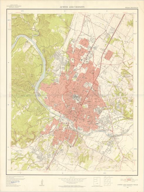
B. Austin and Vicinity, by U.S. Geological Survey (USGS), dated 1957, printed color (25.7 x 32.2"). A large map covering the broader Austin region. Includes remarkable detail of individual buildings, subdivisions, road types, municipal features, and more. Marked "Teaching Set" in the lower left corner. During the 1950’s the USGS published a series of “Metropolitan Area Maps” printed in five colors on a scale of 1 inch per 2000 feet. The map series included the latest survey data for 58 metropolitan areas with exceptional detail. The maps today provide a snapshot of post-war American metropolitan areas before most entered a period of accelerated growth. In 1955 Austin’s population was 159,000. By 1990 the population had tripled. Condition: Folded with one small tear in the left margin closed on verso with archival tape.
References:
Condition: B+
See description above.