Subject: Texas, Oklahoma
Period: 1876 (dated)
Publication:
Color: Hand Color
Size:
19.2 x 25 inches
48.8 x 63.5 cm
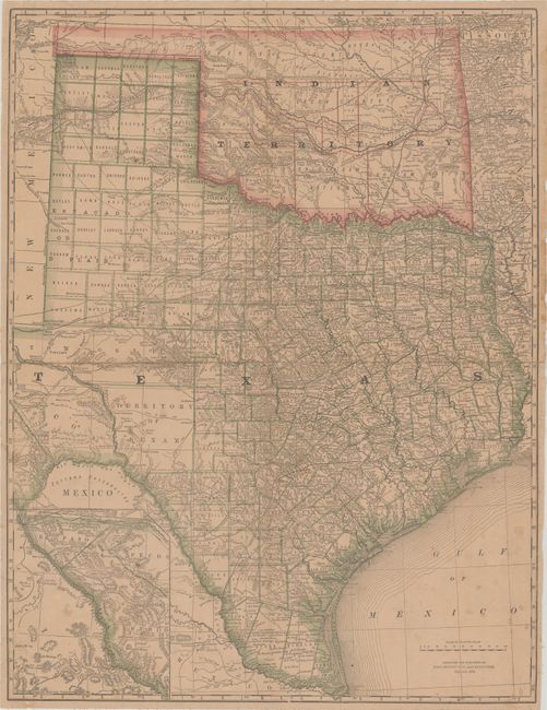
This detailed map of Texas and Indian Territory was issued in the rare second edition of Rand, McNally’s first atlas and is likely their first map of Texas. It shows good detail of settlements in the eastern half of the state with explorer tracks, roads and railroads extending to West Texas. The map was issued shortly after the organization of Young Territory into counties, and Greer County is properly shown in Indian Territory with note "Boundary Claimed by the United States." There are no past sales records for this map individually, and we have only seen it once previously in the aforementioned atlas.
References:
Condition: B
Issued folding and backed on linen with light toning and minor foxing. There are a number of small separations along the vertical fold, some minor creasing at top left, and minor edge chips and tears confined to the right blank margin.