Subject: Washington, D.C.
Period: 1798 (dated)
Publication: Travels Through the States of North America...
Color: Black & White
Size:
8.5 x 6.7 inches
21.6 x 17 cm
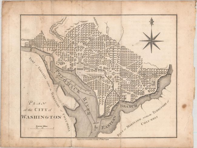
This is a reduced and simplified version of Ellicott's plan of 1792. Washington is bordered by the Potomack (Potomac) River and the Eastern Branch, now the Anacostia River. Georgetown, at the left and northwest of Rock Creek, is separately labeled. Reedy Branch and Tiber Creek are shown to the north outside of the street pattern. A few major buildings including the Capitol and Presidents House are labeled; others are merely outlined. The proposed landscape design for the Mall is shown with some detail. Near the upper right is an eight-pointed compass indicator surmounted by a fleur de lis. Published by John Stockdale on September 16, 1798.
References: Howes #W-235; Phillips (DC) PW #37.
Condition: B
Issued folding with some surface soiling, faint offsetting, and minor extraneous creasing at left.