Subject: Arkansas
Period: 1845-97 (dated)
Publication:
Color:
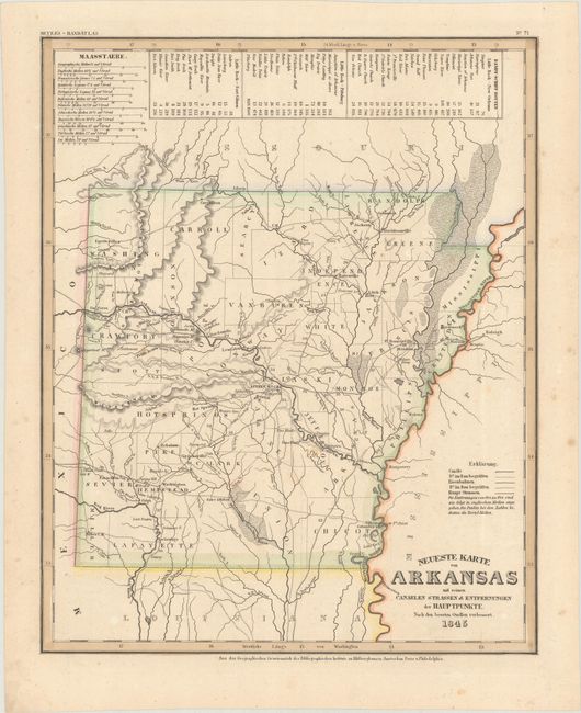
A. Neueste Karte von Arkansas mit Seinen Canelen Strassen & Entfernungen der Hauptpunkte, nach den Bessten Quellen Verbessert, by Joseph Meyer, from Meyer’s Handatlas, dated 1845, hand color (11.8 x 14.6"). German immigrants played a significant role in the development of Arkansas’s economy. This early German map of Arkansas is based on Tanner’s work and is presented in the same format with a table of steamboat routes and distance above the map. County configurations reflect the period just prior to statehood, despite its publication date of 1845. Numerous towns are named, and a number of roads crisscross the map with the number of miles between towns helpfully noted. The distance scale includes 12 different scales, to appeal to every nationality. Published by the Hildburghausen Biblio Institut. Condition: Contemporary color with a bit of minor foxing in the blank margins.
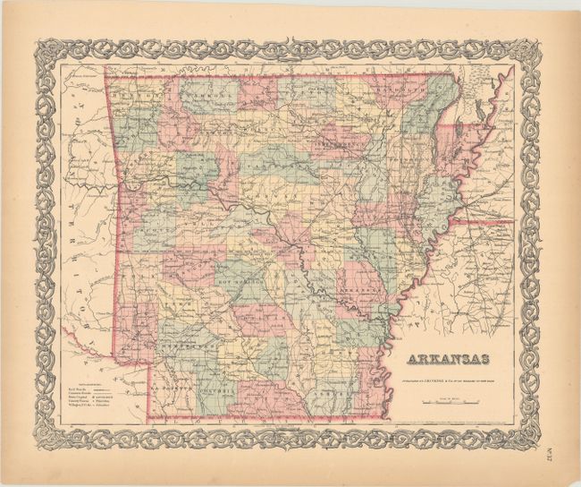
B. Arkansas, by Joseph Hutchins Colton, from Colton’s Atlas of the World, dated 1855, hand color (15.9 x 12.9"). This steel-engraved map depicts Arkansas and its counties. Towns and cities, post offices, and roads are located. The proposed Cairo & Fulton, Ft. Smith, and Memphis & Little Rock railroads are noted, but no completed railways are shown. The map is surrounded by Colton's typical strapwork border. Condition: Contemporary color with marginal toning.
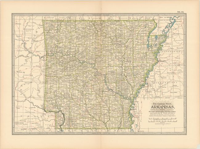
C. Arkansas, by Matthews-Northrup Co., from The Century Atlas, dated 1897, printed color (14.9 x 10.4"). This remarkably precise map from just before the turn of the century is detailed right down to contour lines of elevation. Condition: There is a small chip in the bottom right corner, well away from map image.
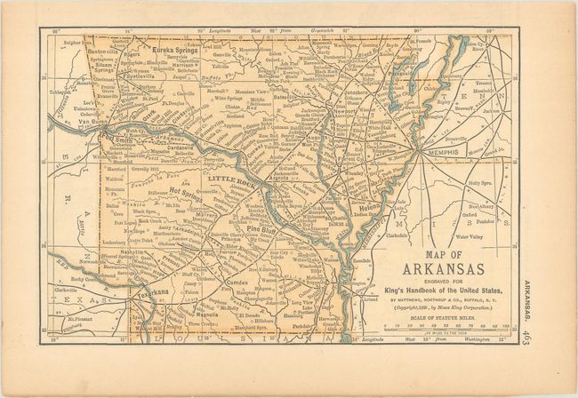
D. Map of Arkansas Engraved for King's Handbook of the United States, by Moses King, from King’s Handbook of the United States, dated 1891, printed color (6.6 x 4.4"). The emphasis of this little map is the rivers and railroads. Condition: There is a tear in blank margin, closed with archival tape, else fine.
References:
Condition: A
See description above.