Subject: Western United States
Period: 1959 (dated)
Publication:
Color: Printed Color
Size:
24.6 x 16.1 inches
62.5 x 40.9 cm
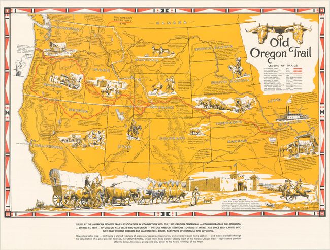
This map highlights the Oregon Trail from Independence, Missouri to the mouth of the Columbia River in Oregon and outlines the numerous routes used by "explorers, trappers, missionaries, and covered wagon home-seekers" to travel west. The map was originally created in 1948 to celebrate the centennial of the admission of Oregon Territory to the United States, and was published with the assistance of the Union Pacific Railroad. This example was published in 1959 to commemorate the 100th anniversary of Oregon's statehood. Notes with facts and historical events are included throughout the map, and images of settlers, Native American Indians, covered wagons, and a steamboat fill the empty spaces. A lovely vignette of Fort Laramie in Wyoming extends across the bottom of the map. Created by Irvin Shope. Irving "Shorty" Shope (1900-1977) was a native of Montana and one of the charter members of the Cowboy Artists of America.
References:
Condition: A
A clean and bright example.