Subject: Western United States
Period: 1857-58 (dated)
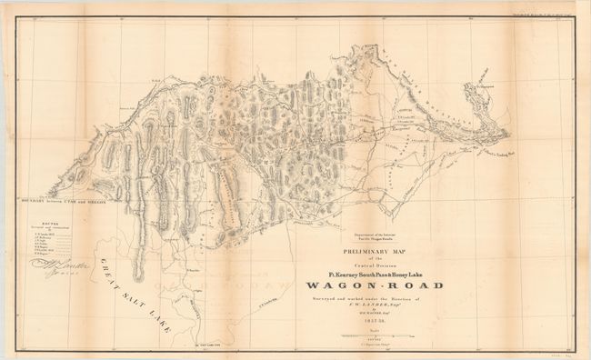
Publication: Sen. Doc. 36 or H.R. Doc. 108, 35th Congress, 2nd Session (Campbell's Wagon Roads)
Color: Black & White
Size:
34.3 x 20.6 inches
87.1 x 52.3 cm
This map was issued in Albert Campbell's report concerning the construction of the Pacific Wagon Road from Independence, Missouri to Honey Lake, California. Centered roughly on Bear Lake, the map extends from City of the Rocks and American Falls in the west to Fort Aspen and Gilbert's Trading Post in the east. Salt Lake City is located at bottom. Locates numerous place names, mountain passes, etc. Names forts: Hall, Piney, Thompson and Aspen.
Carl Wheat devotes a chapter to the Wagon Road project, concluding "The Department of the Interior was caught up in the currents that surrounded the oncoming Civil War, and little came of the imposing wagon road program that it had set in motion. [However] its efforts were of great effect on all parts of the West."
References: Wheat (TMW) #1004.
Condition: B
Issued folding and now flattened and backed with tissue to reinforce and repair several small fold separations. There is light offsetting and minor toning along the folds, and a binding trim at lower left has been replaced with old paper.