Subject: Prince Edward Island, Canada
Period: 1778 (dated)
Publication: Neptune Americo-Septentrional
Color: Black & White
Size:
23.8 x 17 inches
60.5 x 43.2 cm
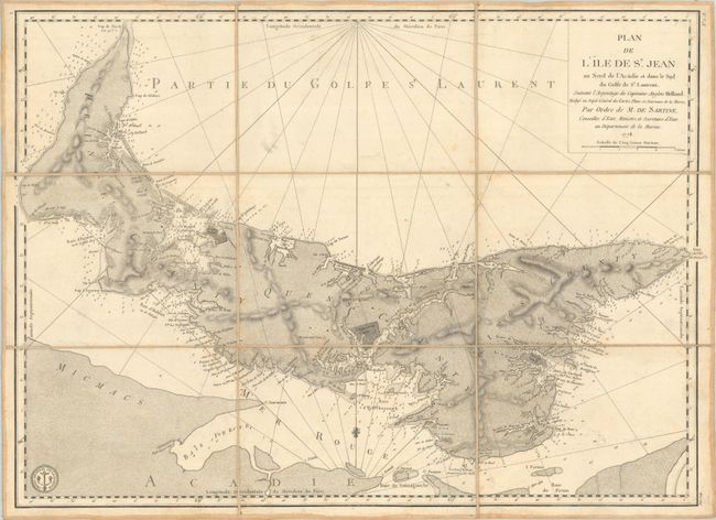
This fine chart was prepared under the direction of Antoine Sartine, Minister of Marine in Paris for use by the French Navy during the American Revolutionary War. It is based upon earlier surveys by Samuel Holland and shows excellent detail along the coastlines including scores of place names, numerous soundings and shoals. Navigational detail extends to the rivers and bays, and the boundaries for Charlottetown, Georgetown, and Princetown are delineated. The chart features good topographical detail in the interior along with the location of many small towns and individual houses. Decorated by rhumb lines in the waters, a fleur-de-lis indicating north, and the seal of the Depot de la Marine in the lower left corner. Engraved by Petit. According to Kershaw, this is the second state of the map with the land being fully stippled.
References: Kershaw #849.
Condition: B+
Dissected and backed with linen. There is some light foxing, minor soiling, and a bit of printer's ink residue. Manuscript title label on verso.