Subject: North America
Period: 1873 (circa)
Publication: Mission of the North American People, Geographical, Social and Political
Color: Hand Color
Size:
22.4 x 23.9 inches
56.9 x 60.7 cm
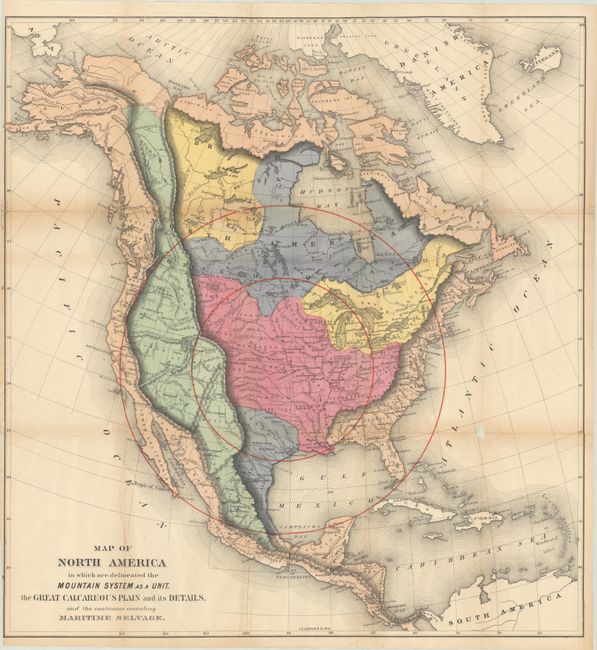
This unusual and colorful map was issued in William Gilpin’s Mission of the North American People, Geographical, Social and Political. The map utilizes bold coloring to suggest related regions and concentric circles to represent the future population density with the center of population at Topeka, Kansas.
Gilpin was the first governor of the territory of Colorado and a proponent of the concept of Manifest Destiny, the transcontinental railway, and a westward expansion of the United States. He had radical ideas on how and why America should be populated, and to support his theories he created a series of maps including this one. Interestingly, Gilpin's maps were some of the first to show economic potential for the West and to think in terms of regional resources and climates.
References:
Condition: B
Issued folding with light toning along the folds and a bit of faint offsetting. There are several repaired fold separations with some small loss at the junctions, most notably in a blank area of the Atlantic Ocean.