Subject: North America
Period: 1814 (published)
Publication: A New General Atlas, Ancient and Modern...
Color: Hand Color
Size:
21 x 17.5 inches
53.3 x 44.5 cm
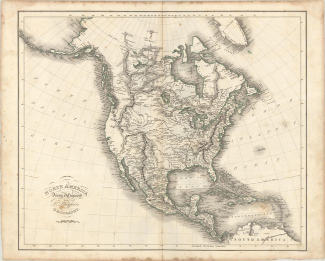
A detailed map of the continent showing the United States confined to east of the Mississippi River with a large Louisiana Territory extending into New Mexico. Issued shortly before the Lewis & Clark findings, the west features an elaborate network of mountains and rivers on the eastern slopes of the Rocky Mountains including the three forks of the Missouri River (Galatin, Madison and Jefferson). The region of present-day California and Oregon is almost entirely void of inland detail with numerous missions named along the coast. In the Arctic, the discoveries of MacKenzie and Hearne are noted, and Alaska's outline is relatively accurate. Engraved by Samuel Neele.
References:
Condition: B+
There is light staining and soiling that is more prominent in the blank margins.