Subject: Atlases
Period: 1822 (published)
Publication:
Color: Hand Color
Size:
12.9 x 16 inches
32.8 x 40.6 cm
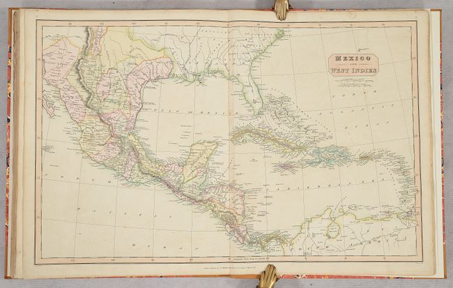
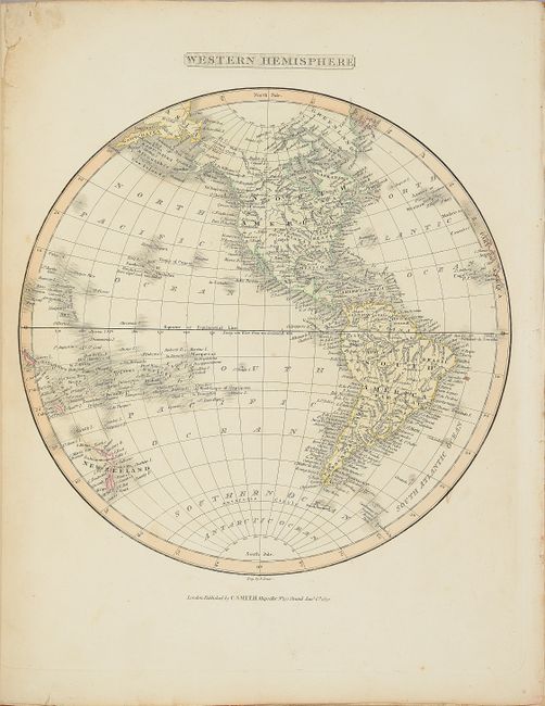
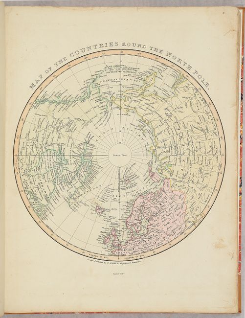
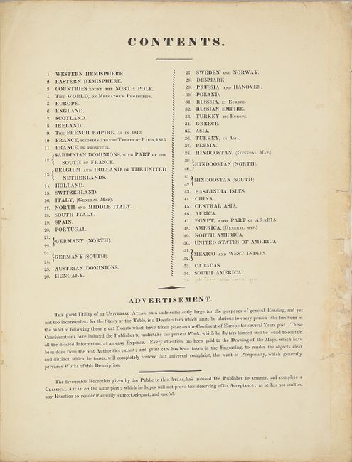
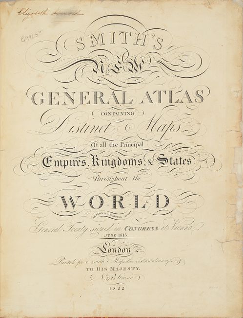
This is an unusually fine and complete example of this important and desirable atlas. All of the maps are finely engraved with full, contemporary hand coloring. The table of contents lists 54 maps, however there are 5 double-page maps with both the right and left-hand pages numbered individually, and four of these double-page maps join to form larger two-sheet maps (of Germany and India). Therefore the actual count is 47 maps on 49 sheets, with a world map, three hemisphere maps, 26 relating to Europe, 9 of Asia, 2 of Africa, and 6 of the Americas.
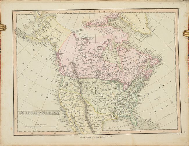
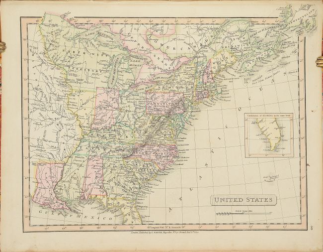
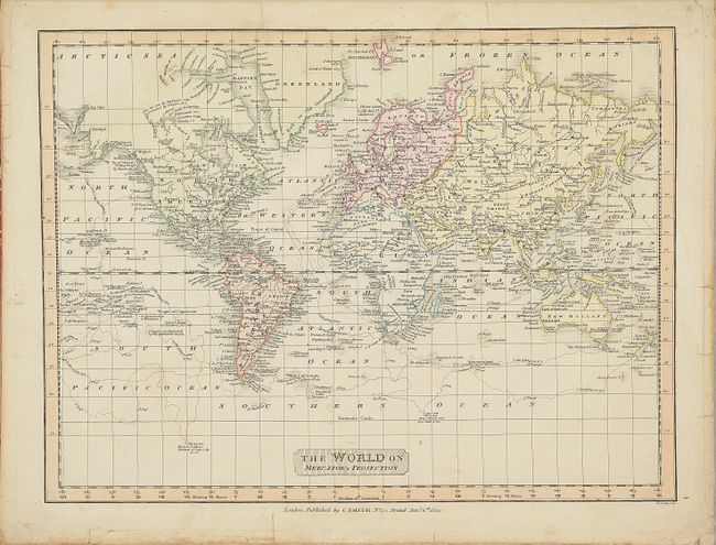
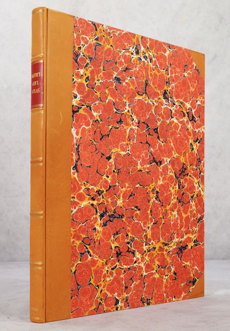
The map of North America shows Spain is in control of the Southwest, extending to the Red River and the Mississippi River to the east. Alaska is Russian Settlements and is completely blank inland. The map of the United States features a large North West Territory west of Lake Michigan. The region west of the Mississippi River is labeled Missouri Territory. The panhandle of Florida is included in a small inset in the Atlantic. In addition to a world map on Mercator's Projection are hemispheric maps of the western, eastern and northern hemispheres (North Pole). This folio atlas has been professionally rebound in quarter tan morocco with tips over red marbled-paper covered boards and new endpapers. Engraved title page by Halliwell, table of contents, and 54 copperplate map sheets.
In addition to the publishing business, Charles Smith & Son sold maps and globes in London in the first half of the 19th century. The elder Smith held the post of "Engraver and Map Seller Extraordinary to H.R.H. the Prince of Wales." This well known father and son team produced many maps and atlases including the New English Atlas, reissued numerous times between 1804-1864, and the New General Atlas, first published in 1808 and reissued several times up to 1836.
This is a very nice and complete example of this atlas.
References:
Condition:
The maps are all excellent impressions on bright sheets with full contemporary color. The majority of the maps are in excellent condition (A), a few of which have small chips along the edges of the sheet or repaired tears confined to the blank margins. A handful of maps are in very good (B+) condition with light soiling. Three maps have repaired tears in the image (England & Wales, Central Asia, and Americas). The title page and list of maps have moderate soiling and a number of chips along the fore-edge that have been repaired. The new bindings are pristine (A+).