Subject: Atlases
Period: 1791 (published)
Publication:
Color: Hand Color
Size:
8.1 x 10.4 inches
20.6 x 26.4 cm
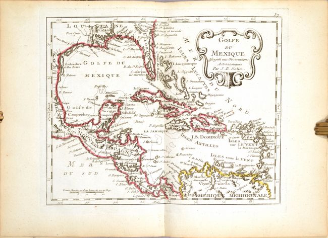
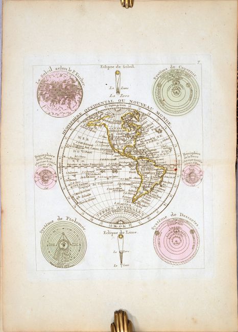
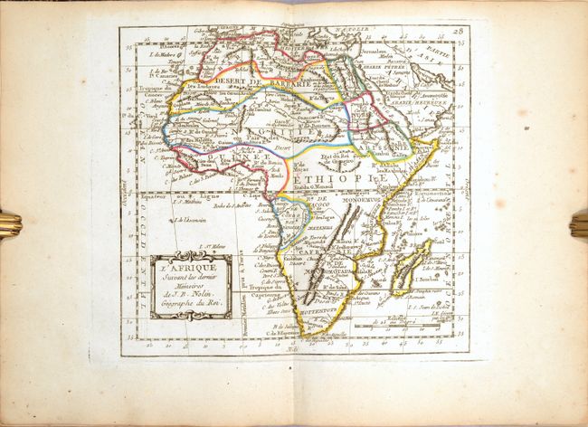
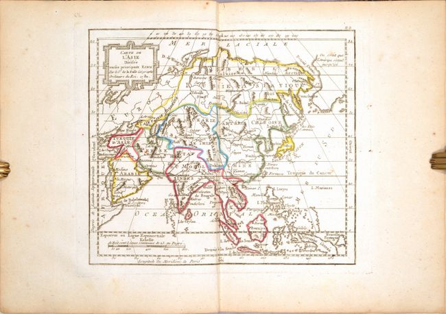
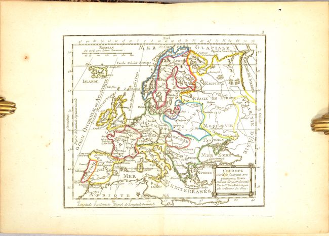
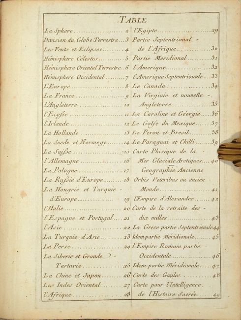
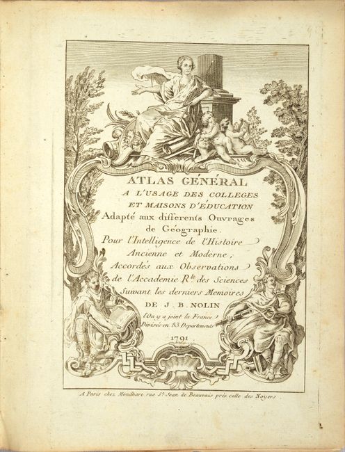
Nolin's charming school atlas was first published in 1783 with this second edition in 1791, both of which were published posthumously. The atlas includes 48 plates, a title page, and a list of maps (with the title page serving as the unlisted plate 1). In addition to maps of the eastern and western hemispheres, there are maps of the four continents, the north pole, 4 celestial/solar system charts, and 9 maps of the ancient world. There are also numerous regional maps, including 5 relating to North America, 2 of South America, 5 of Asia, 3 of Africa, and 13 of Europe. Several of the maps are dated 1780 or 1781; however most of the maps are undated. Of particular interest are the following maps:
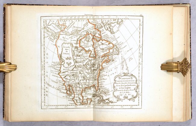
A. Amerique Septentrionale avec les Nouvelles Decouvertes Fait au Nord, par les Russes, et les Anglois. This map of North America features a large Grande Mer de l'Ouest (Sea of the West) in the Pacific Northwest as well as a Northwest Passage that connects through the Arctic via the L. de Valasto and the Malmeles Strait. There are interesting political divisions indicated in North America using dotted lines.
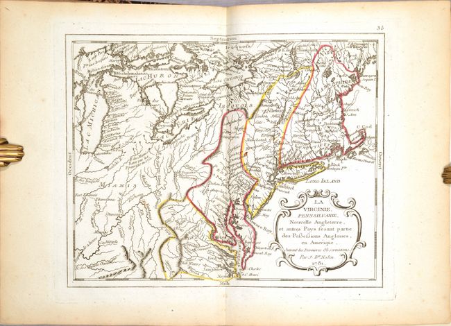
B. La Virginie, Pennsilvanie, Nouvelle Angleterre, et autres Pays Fesant Partie des Possessions Angloises, en Amerique. This map includes parts of New England and the Mid-Atlantic, extending as far west as Lake Michigan. The British colonies are outlined in very odd configurations along mountain ranges and rivers.
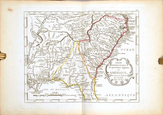
C. Partie Meridionale des Possessions Angloises en Amerique. This map of the Southeast shows the regions east of the Mississippi in an unusual configuration. Present-day Tennessee is named as Caroline, while North and South Carolina are named but shown without a boundary separating them. The regions that would become Alabama, Mississippi, and Georgia are within a large Louisiane and an oddly triangular Floride that reaches up to a range of mountains running east-west from the Appalachians to the Mississippi River. The map is filled with Indian place names.
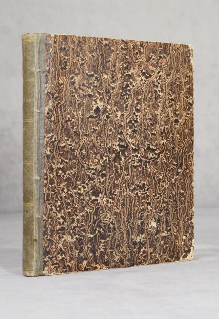
Quarto. Complete with 48 plates, title page, and list of maps. Hardbound in marbled paper boards and olive green embossed cloth spine with gilt bands and "Atlas" in gilt.
References:
Condition: A
The maps are clean and bright in contemporary outline color, with light toning along the edges of the sheets and minor occasional soiling. A few maps have short edge tears and the map of Scotland has a hole in the top blank margin, none of which affect the image. The map of France has several printer's creases, the maps of the eastern and western hemispheres have small abrasions that are less noticeable on the western hemisphere. Three of the four solar system/celestial charts would be considered in B+ condition due to soiling and a small hole in the engraving of the armillary sphere. The rear hinge is starting and the covers have bumped corners and a few small abrasions. The spine is lightly worn and stained.