Subject: Atlases
Period: 1750 (circa)
Publication:
Color: Hand Color
Size:
12.4 x 20.8 inches
31.5 x 52.8 cm
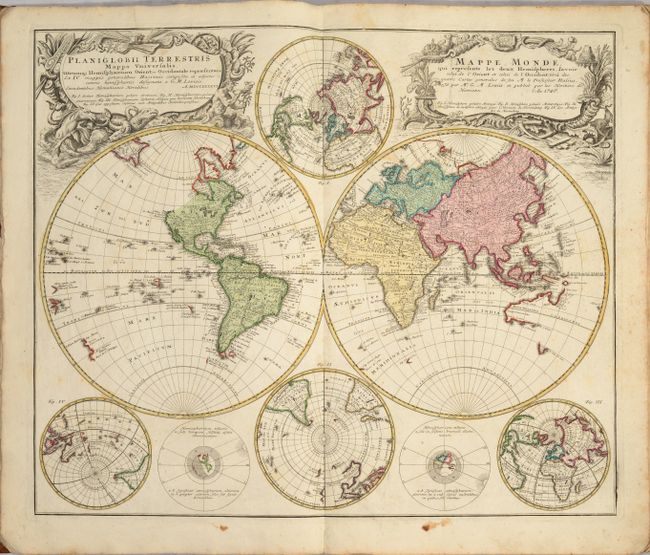
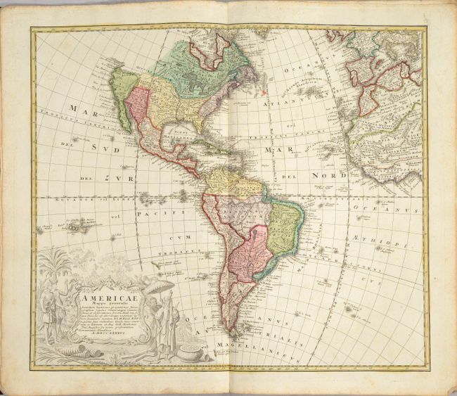
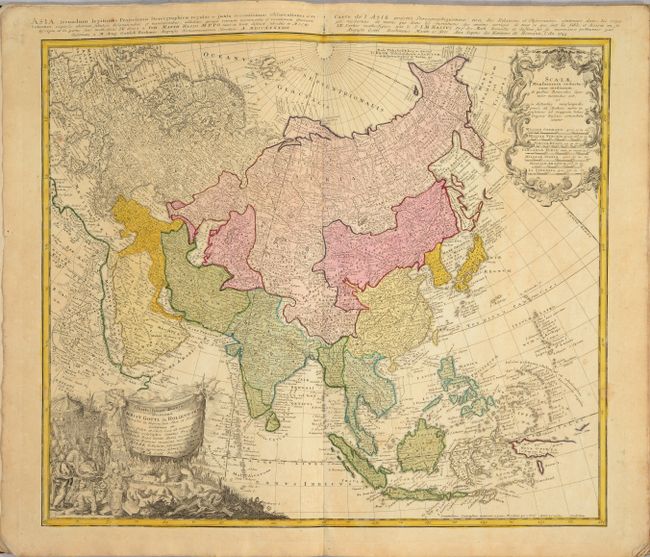
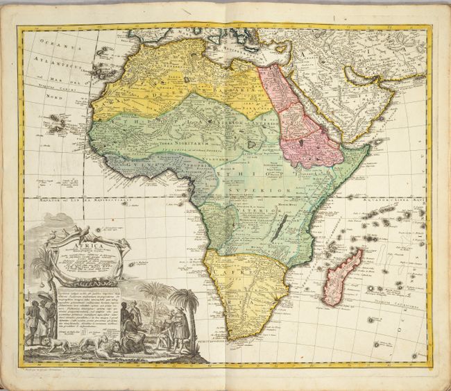
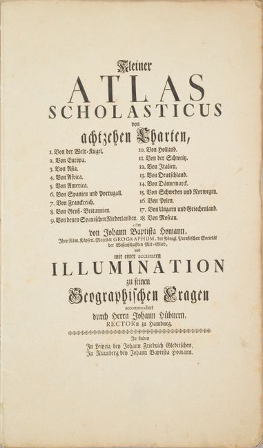
This school atlas includes 18 folio-sized maps by Johann Baptist Homann and Homann Heirs of the world, four continents, 12 maps of countries in Europe, and a map of the Russian Empire. The maps included are:
1. Planiglobii Terrestris Mappa Universalis..., by Homann Heirs, dated 1846.
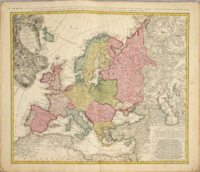
2. Europa Secundum Legitimas Projectionis Stereographicae Regulas, by Homann Heirs, dated 1845. Condition: An archivally repaired centerfold separation that enters 1.5" into image at bottom.
3. Asia Secundum Legitimas Projectionis Stereographicae Regulas, by Homann Heirs, dated 1844.
4. Africa Secundum Legitimas Projectionis Stereographicae Regulas, by Homann Heirs.
5. Americae Mappa Generalis Secundum Legitimas Projectionis Stereographicae Regulas, by Homann Heirs, dated 1846.
6. Regnorum Hispaniae et Portugalliae Tabula Generalis, by J. B. Homann.
7. Regni Galliae seu Franciae et Navarrae Tabula Geographica, by Homann Heirs, dated 1741.
8. Magna Britannia complectens Angliae, Scotiae et Hyberniae Regn. by Homann Heirs, dated 1729.
9. Belgium Catholicum seu Decem Provinciae Germaniae Inferioris, by Homann Heirs, dated 1747.
10. Septem Provinciae seu Belgium Foederatum, by Homann Heirs, dated 1748.
11. Potentissimae Helvetiorum Reipublicae Cantones Tredecim, by Homann Heirs, dated 1732.
12. Italia in suos Status Divisa et ex Prototypo del Isliano Desumta, by Homann Heirs, dated 1742.
13. Imperii Romano-Germanici in suos Status et Circulos Divisi Tabula Generalis, by J. B. Homann.
14. Regni Daniae in quo sunt Ducatus Holsatia et Slesvicum, Insulae Danicae, Provinciae Iutia Scania Blekingia etc., by J. B. Homann.
15. Scandinavia Complectens Sueviae, Daniae & Norvegiae Regna, by J. B. Homann.
16. Mappa Geographica Regni Poloniae, by Homann Heirs, dated 1750.
17. Fluviorum in Europa Principis Danubii cum Adiacentibus Regnis nec non Totius Graeciae et Archipelagi Novissima Tabula, by J. B. Homann.
18. Imperii Russici et Tatariae Universae..., by Homann Heirs, dated 1739.
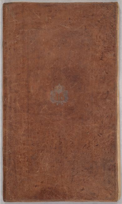
The atlas includes a title page with the list of maps. Elephant Folio. Softbound in full brown leather over paper covers; front cover is embossed with a crown, wings, and "18."
References:
Condition: B+
The maps are in full contemporary color on bright sheets with very light soiling. A few of the maps have archivally repaired centerfold separations at bottom. There are a number of old manuscript notations on the front free-endpaper. The soft covers are well worn but fully intact.