Subject: Atlases
Period: 1628 (published)
Publication:
Color: Black & White
Size:
9.4 x 7 inches
23.9 x 17.8 cm
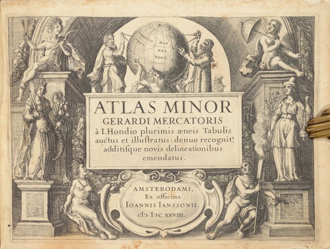
Mercator's Atlas Minor was conceived by Jodocus Hondius in 1607 as a reduced-sized edition of the popular folio-sized Mercator Atlas. The Atlas Minor was intended to be larger than a pocket atlas, yet smaller than the folio atlas, and were priced accordingly to reach a new market. There were three different editions of the Atlas Minor published by different authors, each with a new set of copperplates. Hondius published the first edition from 1607-1621, and subsequently sold the copperplates to parties in England between 1621-1625, after which an English edition was published using many of the original plates in 1635-39. Johannes Jansson wanted to compete in the small atlas market as well, and had new copperplates engraved by Pieter van den Keere and Abraham Goos for his own edition published in multiple languages between 1628-51. The third and final edition was published by Jan Evertsz. Cloppenburch (or Cloppenburg) between 1630-1734 (some without text), with new maps engraved primarily by Pieter van den Keere.
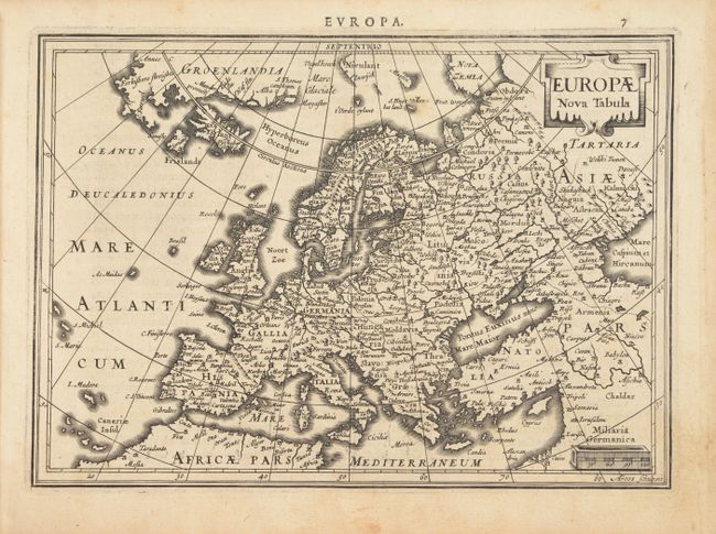
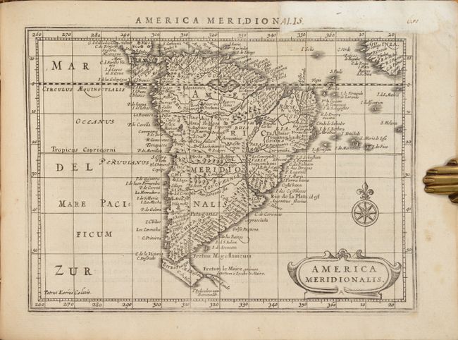
This example is the complete first edition of Jansson's Atlas Minor, published in 1628 with Latin text and 143 maps. Included are maps of the world, continents, north pole, and regional maps of Europe (117), Africa (5), Asia (10), North America (3), and South America (1). Some of the more interesting maps include:
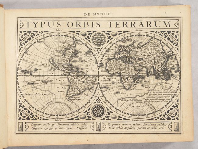
A. Typus Orbis Terrarum is a beautiful double hemisphere world map surrounded in strapwork borders into which are set an armillary sphere and a compass rose. The map features the island of California with no coastline continuing to the northwest. Terra Australis has a broken coastline and a notation that ends with the signature of the engraver, A. Goos. Four lines of Latin text balance the title cartouche at bottom. Reference: Shirley #325.
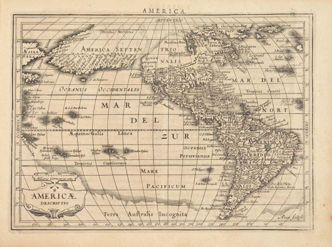
B. The most dominant feature of Americae Descriptio is the curious depiction of the west coast of North America, which is completely bisected by an unnamed strait hinting at a Northwest Passage. The bulging northwest coast of North America continues another 65 degrees and is separated from Asia by a narrow Fretum Anian and California is shown as a peninsula. These features were derived from the Van den Keere and Plancius globe of 1614 and this is the first time they appear on a map of the Americas. Previous maps had depicted the supposed Northwest Passage through the Strait of Anian. Other interesting features include the St. Lawrence River flowing from a small lake in the west, no Great Lakes, and an area of shading in Virginia alluding to the possibility of a Verrazano-type inland sea. In the southern hemisphere, two large mythical lakes appear in South America, Tierra del Fuego is only partially delineated, and there is a massive southern continent (Terra Australis Incognita). Reference: Burden #221.
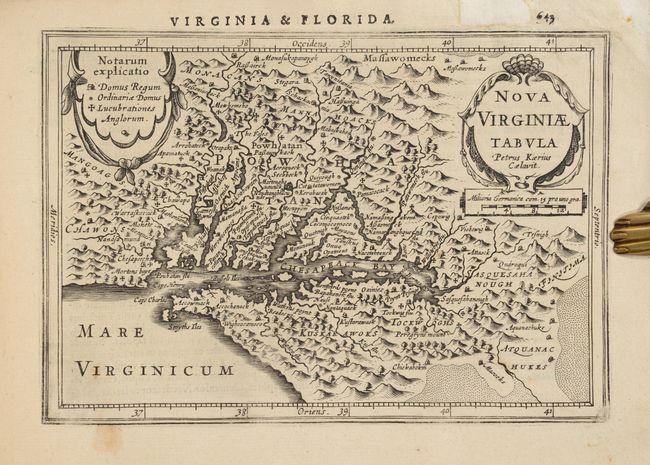
C. Nova Virginiae Tabula is a reduced version of John Smith's map of the Chesapeake Bay region. Although it is the second derivative of Smith's map, it is actually the first derivative published in an atlas. Despite its small size, it is filled with towns with both English and Native names, including Jamestown (Iamestowne), and a key to the types of buildings on the left and pictorial topography. Engraved by Pieter van den Keere with his Latinized name appearing below the title cartouche. This map was a new addition for Jan Jansson's editions of the Atlas Minor, and was not included in Hondius' editions. References: Burden #223; Wooldridge #33.
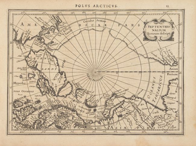
D. The map of the North Pole, Septentrionalium Terrarum Descript., does not follow Mercator, but used the knowledge of the many recent exploratory voyages that attempted to locate a northern route to Asia. Several fictitious islands, including Frisland, appear in the North Atlantic.
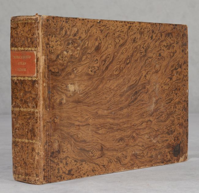
Oblong Octavo; 656 pp. plus title page, preface and index. Hardbound in full leather with gilt tooling and red leather title label on spine.
References:
Condition: B+
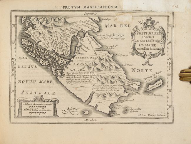
Most of the maps are in excellent condition, with minor toning and occasional soiling. A few maps have contemporary color, typically highlighting major cities. There are professional repairs to some chips and paper weakness in the last 30 pages of the volume due to some dampstaining, mostly affecting the index. These repairs are visible on the maps of Virginia, Cuba, South America and Tierra del Fuego (see images). The binding is sound but the hinges are a little loose. The covers have some abrasions and the spine is cracked along the edges.