Subject: Libya
Period: 1838 (dated)
Publication:
Color: Black & White
Size:
23.8 x 17.8 inches
60.5 x 45.2 cm
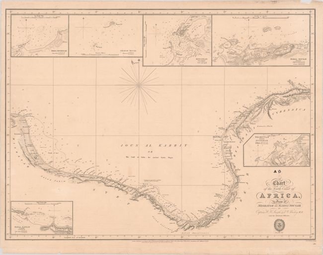
This scarce chart from the Hydrographical Office of the British Admiralty is by Captains William Henry Smyth and Frederick William Beechey. It covers the coast of Libya, spanning from Misrata to Susah. Place names and topographical detail appear along the coastline. There are depth soundings and bottom types in the Mediterranean. The chart includes six inset charts: Marsa Boureigah; Gharah Rocks; Ben-Ghazi; Marsa Sousah - Antient Apollonia; Marsa Zafran - Probably Aspis; and Tolmeitah - Antient Ptolemais. Below the title is the seal of the Hydrographical Office. First published in 1826, corrected to 1838. Captain Smyth (1788-1865) was something of a polymath; in addition to his role as an officer in the Royal Navy, he was also a hydrographer, astronomer, numismatist, author, translator, and an enthusiastic participant in numerous intellectual circles. Beechey (1796-1856) is best known for his important expedition to the northwest coast of North America, when he surveyed around the Bering Strait, named Point Barrow , discovered a harbor near Cape Prince of Wales, and found a number of islands in the Pacific Ocean. Engraved by J. & C. Walker.
References:
Condition: B+
On a slightly toned sheet with a few light spots and several short repaired edge tears in the margins, including one that crosses the neatline at top.